
IMAGES TAKEN NEAR TO
Bourton, MUCH WENLOCK, TF13 6QF
Introduction
This page details the photographs taken nearby to TF13 6QF by members of the Geograph project.
The Geograph project started in 2005 with the aim of publishing, organising and preserving representative images for every square kilometre of Great Britain, Ireland and the Isle of Man.

There are currently over 7.5m images from over14,400 individuals and you can help contribute to the project by visiting https://www.geograph.org.uk
Image Map
Images are licensed for reuse under creativecommons.org/licenses/by-sa/2.0
Notes
- Clicking on the map will re-center to the selected point.
- The higher the marker number, the further away the image location is from the centre of the postcode.
Image Listing (79 Images Found)
Images are licensed for reuse under creativecommons.org/licenses/by-sa/2.0
Image
Details
Distance
1
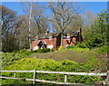
House in Bourton
Secluded setting above the lane towards Presthope.
Image: © JThomas
Taken: 28 Mar 2019
0.00 miles
2
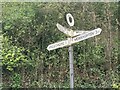
Direction Sign - Signpost at Bourton
Located on the east side of the crossroads on the B4378 in Bourton. Much Wenlock parish. 4 arms and annulus finial.
Milestone Society National ID: SA_SO5996
Image: © D Phillips
Taken: 1 Oct 2023
0.07 miles
4
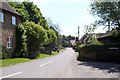
Downtown Bourton
The start of the lane to Monkhopton. It was a lovely sunny day and the village looked like an idyllic place to live.
Image: © Adrian Bailey
Taken: 15 May 2005
0.09 miles
5
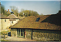
Bourton Farm, Shropshire
All the out-buildings of this old working farm have been converted to holiday lets. They've been well done,but it's a sad sight.
Image: © Carol Walker
Taken: 27 Apr 2007
0.10 miles

7
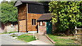
Bourton Post Office
A little Post Office, open four hours per week
Image: © David Turner
Taken: 10 Sep 2011
0.12 miles
8
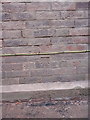
OS benchmark - Bourton Lodge
An OS cutmark on the gable wall of a building facing the main road; originally levelled, probably in 1972, at 197.727m above Ordnance Datum Newlyn.
Image: © Richard Law
Taken: 19 Nov 2017
0.12 miles
9
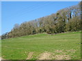
Grazing north west of Bourton
A steep bank towards Henmoorhill Plantation
Image: © JThomas
Taken: 28 Mar 2019
0.12 miles
