IMAGES TAKEN NEAR TO
Slade Lane, MUCH WENLOCK, TF13 6NW
Introduction
This page details the photographs taken nearby to Slade Lane, TF13 6NW by members of the Geograph project.
The Geograph project started in 2005 with the aim of publishing, organising and preserving representative images for every square kilometre of Great Britain, Ireland and the Isle of Man.

There are currently over 7.5m images from over14,400 individuals and you can help contribute to the project by visiting https://www.geograph.org.uk
Image Map
Images are licensed for reuse under creativecommons.org/licenses/by-sa/2.0
Notes
- Clicking on the map will re-center to the selected point.
- The higher the marker number, the further away the image location is from the centre of the postcode.
Image Listing (8 Images Found)
Images are licensed for reuse under creativecommons.org/licenses/by-sa/2.0
Image
Details
Distance
1
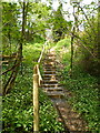
Steps up (or down) a steep path
These lead down from the village of Homer to a bridge over the upper reaches of the Sheinton Brook
Image: © Richard Law
Taken: 3 May 2010
0.03 miles
4
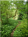
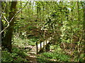
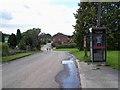
Narrow path through wild garlic
And, my word, doesn't it smell garlicky at this time of year?
Image: © Richard Law
Taken: 3 May 2010
0.15 miles
7
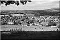
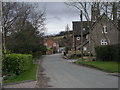
Homer village
A view of Homer village, near Much Wenlock. See also Anthony Park's Image] for a colour view taken a week before my shot from roughly the same place! Taken on film with a Pentax K1000 through a red filter. The Wrekin, a well - known local landmark visible from miles around, is in the background.
Image: © John Winder
Taken: 26 Sep 2015
0.24 miles