
IMAGES TAKEN NEAR TO
Brockton, MUCH WENLOCK, TF13 6JT
Introduction
This page details the photographs taken nearby to TF13 6JT by members of the Geograph project.
The Geograph project started in 2005 with the aim of publishing, organising and preserving representative images for every square kilometre of Great Britain, Ireland and the Isle of Man.

There are currently over 7.5m images from over14,400 individuals and you can help contribute to the project by visiting https://www.geograph.org.uk
Image Map
Images are licensed for reuse under creativecommons.org/licenses/by-sa/2.0
Notes
- Clicking on the map will re-center to the selected point.
- The higher the marker number, the further away the image location is from the centre of the postcode.
Image Listing (5 Images Found)
Images are licensed for reuse under creativecommons.org/licenses/by-sa/2.0
Image
Details
Distance
1
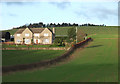
Fields and Larden Grange Farmhouse, Shropshire
Larden Grange Farmhouse was built circa 1990 about two hundred metres north-east of the 1830-ish Larden Grange.
Image: © Roger D Kidd
Taken: 26 Jan 2008
0.01 miles
2
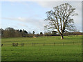
Grazing Land near Larden Hall, Shropshire
Llamas were grazing in a paddock by the house, but were taken elsewhere before I could photograph them.
Image: © Roger D Kidd
Taken: 26 Jan 2008
0.18 miles
3
Farmland near Brockton, Shropshire
The public footpath across this field has not been trodden much recently!
Image: © Roger D Kidd
Taken: 26 Jan 2008
0.19 miles
4
Farm Land towards Larden Hall, Shropshire
Image: © Roger D Kidd
Taken: 26 Jan 2008
0.20 miles
5
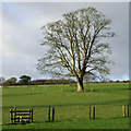
Stile and Oak Tree in Fields near Larden Hall, Shropshire
The public footpath is well signed and the stiles are in good condition. It is a lovely rural area for walking...and you might even see some llamas!
Image: © Roger D Kidd
Taken: 26 Jan 2008
0.22 miles