
IMAGES TAKEN NEAR TO
Bridgnorth Road, MUCH WENLOCK, TF13 6HL
Introduction
This page details the photographs taken nearby to Bridgnorth Road, TF13 6HL by members of the Geograph project.
The Geograph project started in 2005 with the aim of publishing, organising and preserving representative images for every square kilometre of Great Britain, Ireland and the Isle of Man.

There are currently over 7.5m images from over14,400 individuals and you can help contribute to the project by visiting https://www.geograph.org.uk
Image Map
Images are licensed for reuse under creativecommons.org/licenses/by-sa/2.0
Notes
- Clicking on the map will re-center to the selected point.
- The higher the marker number, the further away the image location is from the centre of the postcode.
Image Listing (307 Images Found)
Images are licensed for reuse under creativecommons.org/licenses/by-sa/2.0
Image
Details
Distance
1
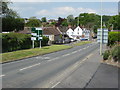
Much Wenlock
The A458 entering Much Wenlock from the south, the white building in the background is the Gaskell Arms Hotel.
Image: © Philip Halling
Taken: 24 May 2008
0.05 miles
2
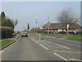
Much Wenlock - A458 at Racecourse Road
Image: © Peter Whatley
Taken: 23 Mar 2012
0.05 miles
3
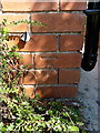
OS benchmark - Much Wenlock, 4 Bridgnorth Road
An OS cutmark on the front wall of a house at 4 Bridgnorth Road; originally levelled at 168.401m above Ordnance Datum Newlyn in 1960. Photographed with the assistance of the house owner, who kindly let me pull the shrubbery back a little.
Image: © Richard Law
Taken: 17 Sep 2016
0.06 miles
4
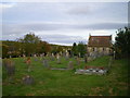
Cemetery and House of Rest on the edge of Much Wenlock
Image: © Richard Law
Taken: 23 Sep 2009
0.06 miles
5
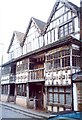
Raynalds's Mansion, Much Wenlock
This is in High Street. The front was added in 1682 to a medieval hall-house
Image: © Humphrey Bolton
Taken: Unknown
0.12 miles
6
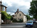
Dutch gable and Gothic windows
Unusual house at the junction of St Mary's Road and Racecourse Road, Much Wenlock.
Image: © Christine Johnstone
Taken: 7 Jul 2012
0.13 miles
7
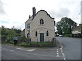
House in Much Wenlock
The Dutch gabling caught my eye.
Image: © Jeremy Bolwell
Taken: 22 Aug 2012
0.13 miles
8
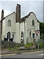
5 St Marys Lane, Much Wenlock
An early 19th century house over two storeys, and in some ways (particularly the pointed-arch window openings) quite similar to Image a little way along the road. No 5 was Grade II listed https://britishlistedbuildings.co.uk/101053786-5-st-marys-lane-much-wenlock#.Yw4RqHbMLIU & https://historicengland.org.uk/listing/the-list/list-entry/1053786 in 1950
Image: © Richard Law
Taken: 23 Aug 2022
0.13 miles
9
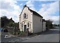
Old Toll House, Much Wenlock
Toll House at the junction of St. Mary's Road and Racecourse Road in the parish of Much Wenlock.
Grade II listed.
List Entry Number: 1053786 https://historicengland.org.uk/listing/the-list/list-entry/1053786
Surveyed
Milestone Society National ID: SA.MUW02
Image: © Milestone Society
Taken: Unknown
0.13 miles
10
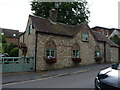
3 St Marys Lane, Much Wenlock
An early 19th century cottage, mainly a single storey residence but with space in the attic; it was Grade II listed https://britishlistedbuildings.co.uk/101053785-3-st-marys-lane-much-wenlock#.Yw4NkHbMLIU & https://historicengland.org.uk/listing/the-list/list-entry/1053785 in 1974.
Image: © Richard Law
Taken: 23 Aug 2022
0.15 miles