
IMAGES TAKEN NEAR TO
Longville, MUCH WENLOCK, TF13 6DT
Introduction
This page details the photographs taken nearby to TF13 6DT by members of the Geograph project.
The Geograph project started in 2005 with the aim of publishing, organising and preserving representative images for every square kilometre of Great Britain, Ireland and the Isle of Man.

There are currently over 7.5m images from over14,400 individuals and you can help contribute to the project by visiting https://www.geograph.org.uk
Image Map
Images are licensed for reuse under creativecommons.org/licenses/by-sa/2.0
Notes
- Clicking on the map will re-center to the selected point.
- The higher the marker number, the further away the image location is from the centre of the postcode.
Image Listing (18 Images Found)
Images are licensed for reuse under creativecommons.org/licenses/by-sa/2.0
Image
Details
Distance
3
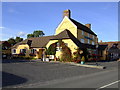
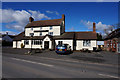
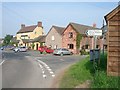
Longville Arms, Longville in the Dale
You can still get a decent pint in this foodie pub.
Image: © al partington
Taken: 20 Sep 2007
0.02 miles
4
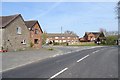
B4371, Longville
Passing the recently closed Longville Arms.
Image: © Richard Webb
Taken: 1 Apr 2019
0.02 miles
8
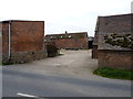
Home Farm, Longville
One of two farms right in the village; the other is Image] opposite here
Image: © Richard Law
Taken: 15 Oct 2011
0.10 miles
9
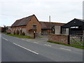
Longville Farm, Longville
One of two farms in the village; the other is Image] on the other side of the road.
Image: © Richard Law
Taken: 15 Oct 2011
0.12 miles
10
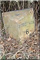
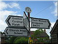
Old Milepost by the B4371, Longville in the Dale, Rushby Parish
Cast iron post by the B4371, in parish of RUSHBURY (SOUTH SHROPSHIRE District), Longville in the Dale; West of Telephone Exchange, by the road, on North West side of road. Wenlock post, erected by the Much Wenlock to Church Stretton turnpike trust in the 19th century.
Inscription reads:- : WENLOCK / 6 - 5FU / (TO THE WYNSTAY ARMS) : : {motif} : : STRETTON / 6 / (TO THE MARKET HALL) :
Milestone Society National ID: SA_CTMW06.
Image: © A Reade/J Higgins
Taken: 1 Mar 2008
0.13 miles