
IMAGES TAKEN NEAR TO
Duke Street, BROSELEY, TF12 5LY
Introduction
This page details the photographs taken nearby to Duke Street, TF12 5LY by members of the Geograph project.
The Geograph project started in 2005 with the aim of publishing, organising and preserving representative images for every square kilometre of Great Britain, Ireland and the Isle of Man.

There are currently over 7.5m images from over14,400 individuals and you can help contribute to the project by visiting https://www.geograph.org.uk
Image Map
Images are licensed for reuse under creativecommons.org/licenses/by-sa/2.0
Notes
- Clicking on the map will re-center to the selected point.
- The higher the marker number, the further away the image location is from the centre of the postcode.
Image Listing (28 Images Found)
Images are licensed for reuse under creativecommons.org/licenses/by-sa/2.0
Image
Details
Distance
1
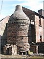
Broseley Pipe Works
This kiln at the Broseley Pipe Works manufactured clay pipes and has been left as it was when finally shut.
Image: © Sarah Charlesworth
Taken: 28 May 2011
0.03 miles
2
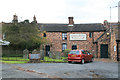
Broseley Pipeworks
A museum of clay tobacco pipes and one of ten administered by the Ironbridge Gorge Museum Trust.
Image: © Chris Allen
Taken: 4 Aug 2012
0.04 miles
3
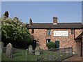
Pipe Museum, Broseley
Broseley was famed for its clay pipes. The factory is the last of around two hundred manufacturers of the famous Broseley Clays which were exported all around the world. The building with the original bottle kiln is now preserved as part of the Ironbridge Gorge Museums. The ironmaster Abrahaham Darby is buried in the Quaker burial ground.
Image: © John M
Taken: 28 Apr 2007
0.05 miles
4
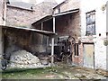
Courtyard at Broseley Pipe Works
With a stack of the raw material for the clay pipes once made here. Part of the Ironbridge Gorge Museum.
Image: © Christine Johnstone
Taken: 9 Jul 2012
0.05 miles
5
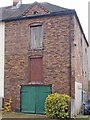
Maltsters, Broseley
The sign painted on the wall to the left of the upper door reads:
T.P.EVERALL MALTSTER, AGENT FOR F.W.Soames & Co
FIRST PRIZE MEDAL WREXHAM ALES AND...
That's where it ends.
Note that it is a separate building from the one it adjoins; the brickwork is not keyed in. Note also the hole where the crane used to haul barley to the upper floors used to be.
Image: © Mike White
Taken: 2 Nov 2008
0.08 miles
6

Former Wesleyan School, Broseley
According to the stone inlaid in the gable wall, this was built in 1841; it's clearly now a private residence, and has been somewhat extended.
Image: © Richard Law
Taken: 29 Oct 2010
0.09 miles
7
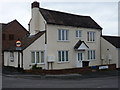
The former Lord Hill pub, Broseley
Now converted to flats.
Image: © Richard Law
Taken: 29 Oct 2010
0.10 miles
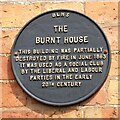
9
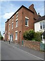
Burnt House, Broseley
Burnt House in Broseley was a social club used by both the Liberal Party and Labour Party in the early 20th century.
Image: © Philip Halling
Taken: 2 Jun 2021
0.12 miles
10
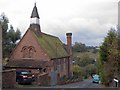
Broseley Wood Infants School, Legges Hill
Since submitting this image I have received a kind note from a local man: "I attended this school in 1945. After about eighteen months there we were sent down to Broseley C of E school, which is now the library Image We attended the infants' department of this part of the school; first in Miss Smitheman's class, then Miss Smallwood's, and finally into Mrs Garbett's class. We then transferred into what was known as the big boys' section where we stayed until we were about eleven and then sent to Madeley Modern School [now Abraham Darby Academy, SJ673040. Geograph has no picture of this building!], Coalbrookdale, or Walker Tech Image This was all according to how clever you were or if your parents had plenty of money."
It is now the home of the Broseley Detachment of the Shropshire Army Cadet Force.
Image: © Mike White
Taken: 2 Nov 2008
0.14 miles