
IMAGES TAKEN NEAR TO
The Close, Smithy Bank, BROSELEY, TF12 5ES
Introduction
This page details the photographs taken nearby to The Close, Smithy Bank, TF12 5ES by members of the Geograph project.
The Geograph project started in 2005 with the aim of publishing, organising and preserving representative images for every square kilometre of Great Britain, Ireland and the Isle of Man.

There are currently over 7.5m images from over14,400 individuals and you can help contribute to the project by visiting https://www.geograph.org.uk
Image Map
Images are licensed for reuse under creativecommons.org/licenses/by-sa/2.0
Notes
- Clicking on the map will re-center to the selected point.
- The higher the marker number, the further away the image location is from the centre of the postcode.
Image Listing (51 Images Found)
Images are licensed for reuse under creativecommons.org/licenses/by-sa/2.0
Image
Details
Distance
5
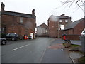
Part of Dark Lane, Broseley in the rain
A sudden wintry squall lashes in on the side streets of this interesting small town.
Image: © Jeremy Bolwell
Taken: 3 Jan 2012
0.05 miles
6
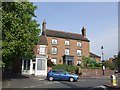
Broseley House
Town House in the centre of Broseley is now a Guest House, handy for the Ironbridge Gorge World Heritage Site. The tall chimneys are a feature of buildings in the town.
Image: © John M
Taken: 28 Apr 2007
0.05 miles
9
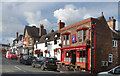
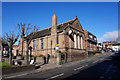
The Old Butchers Shop Bar
Change of use along Broseley High Street.
Image: © Des Blenkinsopp
Taken: 28 Sep 2022
0.05 miles
10
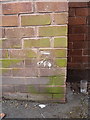
OS benchmark - Broseley, Co-op Supermarket
An OS cutmark on the rear/side wall of the Co-op supermarket in the town; originally levelled in the mid 1960s at 153.388m above Ordnance Datum Newlyn.
Image: © Richard Law
Taken: 31 Jan 2016
0.06 miles