
IMAGES TAKEN NEAR TO
Bridgnorth Road, BROSELEY, TF12 5DP
Introduction
This page details the photographs taken nearby to Bridgnorth Road, TF12 5DP by members of the Geograph project.
The Geograph project started in 2005 with the aim of publishing, organising and preserving representative images for every square kilometre of Great Britain, Ireland and the Isle of Man.

There are currently over 7.5m images from over14,400 individuals and you can help contribute to the project by visiting https://www.geograph.org.uk
Image Map
Images are licensed for reuse under creativecommons.org/licenses/by-sa/2.0
Notes
- Clicking on the map will re-center to the selected point.
- The higher the marker number, the further away the image location is from the centre of the postcode.
Image Listing (62 Images Found)
Images are licensed for reuse under creativecommons.org/licenses/by-sa/2.0
Image
Details
Distance
1

Plaque on The Lawns
Plaque on The Lawns to Ironmaster, John "Iron-Mad" Wilkinson.
Image: © Philip Halling
Taken: 2 Jun 2021
0.10 miles
2
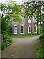
The Lawns
The Lawns, the home of ironmaster John "Iron-Mad" Wilkinson. The early 18th century house is Grade II* listed, see: https://historicengland.org.uk/listing/the-list/list-entry/1053900
Image: © Philip Halling
Taken: 2 Jun 2021
0.10 miles
3
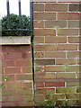
OS benchmark - Broseley, Upper Croft
An OS cutmark on the wall of a small apartment block called Upper Croft; originally levelled in the mid 1960s at 143.142m above Ordnance Datum Newlyn.
Image: © Richard Law
Taken: 31 Jan 2016
0.11 miles
4
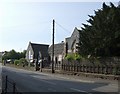
Library and Health Centre
An old school building accommodates the library and health centre in the centre of Broseley.
Image: © John M
Taken: 28 Apr 2007
0.11 miles
5
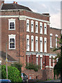
Whitehall, Broseley
One of several large, brick Georgian houses in the village, this early-C18th example of five bays and three storeys has giant Tuscan pilasters at the angles and decorative keystones above the windows, but the blocky C19th bays detract from the facade. Grade II listed.
Image: © Stephen Richards
Taken: Unknown
0.12 miles
6
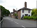
Gothic cottage
Gothic cottage on Church Street in Broseley. This cottage which is Grade II listed https://historicengland.org.uk/listing/the-list/list-entry/1367514 was built by ironmaster John Wilkinson.
Image: © Philip Halling
Taken: 2 Jun 2021
0.12 miles
7
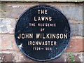
Plaque: The Lawns, Broseley
Spiders have made their homes behind this plaque marking the home of John Wilkinson.
Image: © Mike White
Taken: 2 Nov 2008
0.12 miles
8
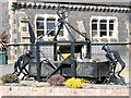
Steel Sculpture by GJ Foxall
Broseley Town Council arranged for six steel sculptures by Gerry Foxall that had been displayed at the Ironbridge Gorge Power Station (being demolished in 2019/20) to be saved and located around the town. This one is outside the library.
Image: © Mike White
Taken: 25 May 2017
0.12 miles
9
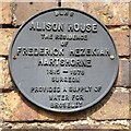
Plaque on Alison House
Plaque on Alison House which was home to Frederick Hezekiah Hartshorne.
Image: © Philip Halling
Taken: 2 Jun 2021
0.13 miles
10
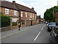
Alison House, Broseley
Alison House on Church Street was the home of physician and surgeon, Frederick Hezekiah Hartshorne. Image
Image: © Philip Halling
Taken: 2 Jun 2021
0.13 miles