IMAGES TAKEN NEAR TO
Ironbridge Road, BROSELEY, TF12 5AD
Introduction
This page details the photographs taken nearby to Ironbridge Road, TF12 5AD by members of the Geograph project.
The Geograph project started in 2005 with the aim of publishing, organising and preserving representative images for every square kilometre of Great Britain, Ireland and the Isle of Man.

There are currently over 7.5m images from over14,400 individuals and you can help contribute to the project by visiting https://www.geograph.org.uk
Image Map
Images are licensed for reuse under creativecommons.org/licenses/by-sa/2.0
Notes
- Clicking on the map will re-center to the selected point.
- The higher the marker number, the further away the image location is from the centre of the postcode.
Image Listing (27 Images Found)
Images are licensed for reuse under creativecommons.org/licenses/by-sa/2.0
Image
Details
Distance
1
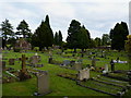
Broseley Cemetery and the chapel of rest
Image: © Richard Law
Taken: 24 Aug 2010
0.04 miles
2
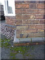
OS benchmark - Broseley, 39 Ironbridge Road
An OS cutmark on the side wall of Coneybury; originally levelled in 1958 at 118.919m above Ordnance Datum Newlyn.
Image: © Richard Law
Taken: 31 Jan 2016
0.04 miles
3
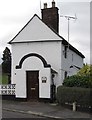
Bottomcoal Colliery Toll House, Broseley
Toll House by the B4373, in the parish of Broseley, Turnpike Cottage, Ironbridge Road.
Shropshire HER.
HER Number (PRN): 33120 https://www.heritagegateway.org.uk/Gateway/Results_Single.aspx?uid=MSA35967&resourceID=1015
Surveyed
Milestone Society National ID: SA.BRO01
Image: © Milestone Society
Taken: Unknown
0.10 miles
4
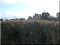
A glimpse of Coneybury Farm near Broseley
The wing of the farm house is very narrow and therefore eyecatching.
Image: © Jeremy Bolwell
Taken: 3 Jan 2012
0.12 miles
5
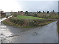
Access road to Coneybury Farm, Broseley
The farm is situated on a small but commanding hill and looks a very interesting building.
Image: © Jeremy Bolwell
Taken: 3 Jan 2012
0.14 miles
6

Fields, Broseley
An area of green just north of the church.
Image: © Stephen Richards
Taken: Unknown
0.16 miles
7
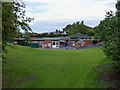
The John Wilkinson Primary School, Coalport Road
Image: © Richard Law
Taken: 24 Aug 2010
0.17 miles
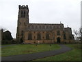
9
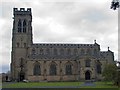
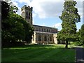
All Saints Parish Church, Broseley
This church has gargoyles which project far from the tower, and some unusual cast-iron gravestones.
Image: © Mike White
Taken: 2 Nov 2008
0.19 miles