
IMAGES TAKEN NEAR TO
Regent Street, TELFORD, TF1 1PE
Introduction
This page details the photographs taken nearby to Regent Street, TF1 1PE by members of the Geograph project.
The Geograph project started in 2005 with the aim of publishing, organising and preserving representative images for every square kilometre of Great Britain, Ireland and the Isle of Man.

There are currently over 7.5m images from over14,400 individuals and you can help contribute to the project by visiting https://www.geograph.org.uk
Image Map
Images are licensed for reuse under creativecommons.org/licenses/by-sa/2.0
Notes
- Clicking on the map will re-center to the selected point.
- The higher the marker number, the further away the image location is from the centre of the postcode.
Image Listing (60 Images Found)
Images are licensed for reuse under creativecommons.org/licenses/by-sa/2.0
Image
Details
Distance
2
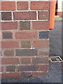
OS benchmark - Wellington New College
An OS cutmark in the bricks of one of New College's buildings; originally levelled at 105.802m above Ordnance Datum Newlyn.
Image: © Richard Law
Taken: 8 Dec 2013
0.09 miles
3
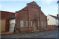
Former Drill Hall - King Street
Built in 1889 for Shropshire Yeomanry D Squadron and 1st Shropshire & Staffordshire Artillery Volunteers.
Image: © John M
Taken: 1 Feb 2014
0.09 miles
4
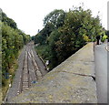
Railway cutting east of King Street bridge, Wellington
Looking east away from Wellington railway station.
The next stations ahead are Oakengates and Telford Central.
Image: © Jaggery
Taken: 10 Oct 2013
0.10 miles
5
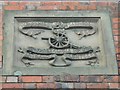
Drill Hall - King Street
Image] Emblem of the Artillery Volunteers.
The motto of the Royal Artillery translates as 'Always, where right and glory lead'.
Image: © John M
Taken: 1 Feb 2014
0.12 miles
6
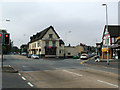
Cock Hotel and old A5
The Cock Hotel is a former coaching inn situated on the A5 or London-Holyhead Road, formerly the Roman road of Watling Street. The development along the road is still known as Watling Street. It is south of the town of Wellington - the road to the right is Mill Bank named after a long disappeared windmill.
Image: © Bob Bowyer
Taken: 3 Sep 2005
0.12 miles
7
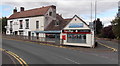
John Cotton print & design shop, Wellington
On the corner of High Street and King Street, next door to The Olde Kings Head.
Image: © Jaggery
Taken: 10 Oct 2013
0.13 miles
8
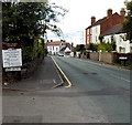
Mill Bank, Wellington
Viewed from the corner of Church Walk http://www.geograph.org.uk/photo/3703643 looking along Mill Bank
towards the junction with High Street and King Street.
Image: © Jaggery
Taken: 10 Oct 2013
0.13 miles
9
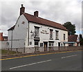
The Olde Kings Head, Wellington
Pub in High Street near the King Street junction.
Image: © Jaggery
Taken: 10 Oct 2013
0.13 miles
10
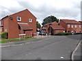
Lowe Court, Wellington
Viewed from the corner of High Street.
Image: © Jaggery
Taken: 10 Oct 2013
0.14 miles