
IMAGES TAKEN NEAR TO
Caynton, SHIFNAL, TF11 9JD
Introduction
This page details the photographs taken nearby to TF11 9JD by members of the Geograph project.
The Geograph project started in 2005 with the aim of publishing, organising and preserving representative images for every square kilometre of Great Britain, Ireland and the Isle of Man.

There are currently over 7.5m images from over14,400 individuals and you can help contribute to the project by visiting https://www.geograph.org.uk
Image Map
Images are licensed for reuse under creativecommons.org/licenses/by-sa/2.0
Notes
- Clicking on the map will re-center to the selected point.
- The higher the marker number, the further away the image location is from the centre of the postcode.
Image Listing (15 Images Found)
Images are licensed for reuse under creativecommons.org/licenses/by-sa/2.0
Image
Details
Distance
1
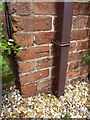
OS benchmark - Peewit Cottage
An OS cutmark in the front brickwork of Peewit Cottage; originally levelled in 1959 at 73.755m above Ordnance Datum Newlyn.
Image: © Richard Law
Taken: 11 May 2014
0.00 miles
4
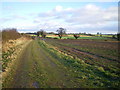
Permissive bridleway down to the road corner
Image: © Richard Law
Taken: 20 Dec 2009
0.13 miles
5
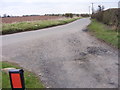
Caynton View
The view from Caynton Cottages near Ryton Shropshire, on part of the Monarch's Way.
Image: © Gordon Griffiths
Taken: 26 Feb 2016
0.14 miles
7
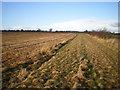
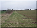
Fieldside bridleway, Caynton
It looks like the footpath just to the east of here has been supplanted by this permissive bridleway that goes around the field margins, and rejoins the roadway at the next sharp corner.
Image: © Richard Law
Taken: 20 Dec 2009
0.17 miles
10
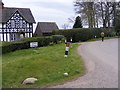
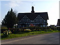
Caynton Cottages View
The view of Caynton Cottages near Ryton Shropshire, on part of the Monarch's Way.
Image: © Gordon Griffiths
Taken: 26 Feb 2016
0.19 miles