
IMAGES TAKEN NEAR TO
Cornmill Gardens, SHIFNAL, TF11 8BG
Introduction
This page details the photographs taken nearby to Cornmill Gardens, TF11 8BG by members of the Geograph project.
The Geograph project started in 2005 with the aim of publishing, organising and preserving representative images for every square kilometre of Great Britain, Ireland and the Isle of Man.

There are currently over 7.5m images from over14,400 individuals and you can help contribute to the project by visiting https://www.geograph.org.uk
Image Map
Images are licensed for reuse under creativecommons.org/licenses/by-sa/2.0
Notes
- Clicking on the map will re-center to the selected point.
- The higher the marker number, the further away the image location is from the centre of the postcode.
Image Listing (383 Images Found)
Images are licensed for reuse under creativecommons.org/licenses/by-sa/2.0
Image
Details
Distance
2
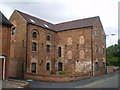
Converted mill building in Shifnal
After many years lying more or less abandoned, this old mill has been converted to flats, bringing some elegant living to the town; a terrace of houses has also been built behind it.
Image: © Richard Law
Taken: 7 Jun 2009
0.02 miles
3
Shifnal Medical Centre
One part of the Shifnal and Priorslee Medical Practice.
Image: © Richard Law
Taken: 7 Jun 2009
0.02 miles
5
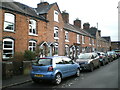
Cottages on Shrewsbury Fields
Lying directly opposite Image, these slightly larger houses appear to be of a similar period, most probably late 19th century.
Image: © Richard Law
Taken: 22 Dec 2020
0.04 miles
6
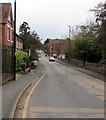
West along Shrewsbury Road, Shifnal
The B4379 Shrewsbury Road viewed from near the corner of Broadway in the centre of Shifnal.
Image: © Jaggery
Taken: 16 Nov 2015
0.04 miles
7
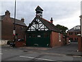
Shifnal's former fire station - now the town museum
14 years on from Image, but recognisably the same building. It's been spruced up and re-purposed as a town museum and 'heritage'/information centre, and usually has a good collection of local historical photos and info on display. It suffered a bit of flooding (somewhat ironically, as a former fire station) last winter, and of course its opening hours have been somewhat curtailed by the 2020/2021 Covid-19 pandemic.
Image: © Richard Law
Taken: 30 Jul 2021
0.04 miles
8

Fire Insurance plaque - Shifnal's old fire station
This is not an original feature of the building, as it makes no appearance in Image (and anyway, who'd insure a fire station against fire in those days?) It's presumably been relocated here from another building in the town, as the old fire station now serves as a small museum and information centre.
Vintage Fire Plaques, such as this 'Sun' version, were used as visual evidence from the late 17th century onwards that the building was covered by one of the fire-extinguishing services of the time, there being no national service at that point. The 'Sun' company presumably lives on as (Royal) Sun Alliance.
Image: © Richard Law
Taken: 8 Aug 2021
0.04 miles
9
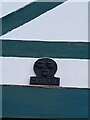
Fire Insurance plaque - Shifnal's old fire station
The second Fire Insurance Plaque now affixed to the front wall of Image, a relatively recent addition.
Fire Plaques, such as this 'Salop' version, were used as visual evidence from the late 17th century onwards that the building was covered by one of the fire-extinguishing services of the time, there being no national service at that point. The Salop Fire company was presumably based at Image in Shrewsbury, as the inscription above one of the doors of that building says 'Salop Fire Office'
Image: © Richard Law
Taken: 8 Aug 2021
0.04 miles
10
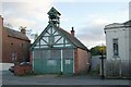
Shifnal old fire station
Shifnal old fire station, Shrewsbury Road, Shifnall, Shropshire
Image: © Kevin Hale
Taken: 31 Oct 2007
0.04 miles