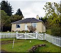
IMAGES TAKEN NEAR TO
HAWICK, TD9 9TY

Introduction

This page details the photographs taken nearby to TD9 9TY by members of the Geograph project.

The Geograph project started in 2005 with the aim of publishing, organising and preserving representative images for every square kilometre of Great Britain, Ireland and the Isle of Man.

There are currently over 7.5m images from over14,400 individuals and you can help contribute to the project by visiting https://www.geograph.org.uk

Image Map


Images are licensed for reuse under creativecommons.org/licenses/by-sa/2.0
Notes
  • Clicking on the map will re-center to the selected point.
  • The higher the marker number, the further away the image location is from the centre of the postcode.

Image Listing (48 Images Found)

Images are licensed for reuse under creativecommons.org/licenses/by-sa/2.0
  • ...
Image
Details
Distance
1
Windshielknowe
On the B6399
Image: © Brian Bailey Taken: 24 Oct 2003
0.02 miles
2
Windshielknowe Cottage
Looking north on the B3699
Image: © James Denham Taken: 2 Jun 2008
0.02 miles
3
Windshielknowe cottage
A lonely but pretty home up on the B6399.
Image: © Peter Bond Taken: 29 Sep 2012
0.02 miles
4
Windshielknowe in the mist
Image: © Jonathan Thacker Taken: 18 Aug 2018
0.03 miles
5
Waverley Route Heritage Centre
Image: © Nick Mutton 01329 000000 Taken: 11 Aug 2007
0.04 miles
6
Waverley Route Heritage Centre
Image: © Nick Mutton 01329 000000 Taken: 11 Aug 2007
0.05 miles
7
Whitrope Summit
A commemorative plaque at the side of the former Waverley Line near the Waverley Route Heritage Association Whitrope Heritage Centre. Form more information on the WRHA, see http://wrha.org.uk/
Image: © James T M Towill Taken: 1 Sep 2013
0.07 miles
8
Early days at the Whitrope Heritage Centre
In 2005 the Waverley Route Heritage Association had not long been occupying the site at the summit at Whitrope Siding, between Hawick and Riccarton Junction on the Edinburgh to Carlisle main line, which had been controversially closed in January 1969. This photo shows the recently levelled area north of Signalbox Cottage, with the B6399 Hawick - Newcastleton Road passing Windshielknowe cottage on the right. On the left a length of railway track has been laid on the old formation, disappearing round the bend towards Whitrope Tunnel.
Image: © A-M-Jervis Taken: 21 Aug 2005
0.08 miles
9
Railway at Whitrope Heritage Centre
A section of the former Waverley Line south of the Whitrope tunnel exit, at an altitude of over 300m.
Image: © Jim Barton Taken: 7 Apr 2017
0.08 miles
10
Crossing the line
Whitrope Heritage Centre. A relaid section of the former Waverley route.
Image: © Jonathan Thacker Taken: 18 Aug 2018
0.08 miles
  • ...