IMAGES TAKEN NEAR TO
HAWICK, TD9 7NF
Introduction
This page details the photographs taken nearby to TD9 7NF by members of the Geograph project.
The Geograph project started in 2005 with the aim of publishing, organising and preserving representative images for every square kilometre of Great Britain, Ireland and the Isle of Man.

There are currently over 7.5m images from over14,400 individuals and you can help contribute to the project by visiting https://www.geograph.org.uk
Image Map
Images are licensed for reuse under creativecommons.org/licenses/by-sa/2.0
Notes
- Clicking on the map will re-center to the selected point.
- The higher the marker number, the further away the image location is from the centre of the postcode.
Image Listing (16 Images Found)
Images are licensed for reuse under creativecommons.org/licenses/by-sa/2.0
Image
Details
Distance
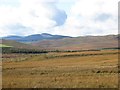
2
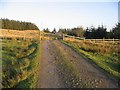
Road, Redfordgreen
Open cattle grazing north of the B711.
Image: © Richard Webb
Taken: 11 Oct 2014
0.10 miles
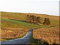
3
The road to Drycleuchlea
The turn right for Westredfordgreen is just ahead.
Image: © Oliver Dixon
Taken: 23 May 2016
0.11 miles
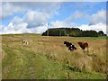
4
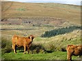
Cattle, Redfordgreen
There is a new borrow pit in the background, dug for roads in the new forestry plantations.
Image: © Richard Webb
Taken: 11 Oct 2014
0.15 miles
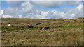
5
Rough grazing, Redfordgreen
Grazed by cattle.
Image: © Richard Webb
Taken: 11 Oct 2014
0.17 miles
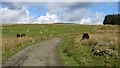
6
Cattle, Redfordgreen
The hillside in the background has been planted with trees. Almost all land between here and the Ettrick Water, other than that which is forested, is grazed by cattle.
Image: © Richard Webb
Taken: 11 Oct 2014
0.17 miles
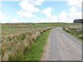
7
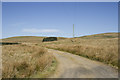
The rough road to West Redfordgreen
Standing under the pole mounted power lines we look along the track to West Redfordgreen. The track cuts across rough moorland.
Image: © Malcolm Neal
Taken: 5 May 2017
0.18 miles
8
Cattle, Redfordgreen
There is a better road to the farm left of the picture.
Image: © Richard Webb
Taken: 11 Oct 2014
0.19 miles
9
Bellendean
Hawick to Ettrick road just by the Roxburgh/Selkirk border. The old map has a school marked here, no trace now.
Image: © Richard Webb
Taken: 11 Nov 2006
0.21 miles
10
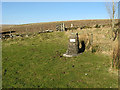
Redfordgreen School cairn
This cairn on the north side of the B711 road marks the place where Redfordgreen School used to be. The plaque on the cairn reads:
Site of
REDFORDGREEN
SCHOOL
1885 to 1955
Image: © Walter Baxter
Taken: 16 Feb 2008
0.22 miles