1
Road above Newcastleton
On a bank holiday Monday, motorcyclists favour the scenic moorland road between Langholm and Newcastleton.
Image: © Oliver Dixon
Taken: 13 Apr 2009
0.04 miles
2
Descent to Newcastleton
The moorland road from Langholm.
Image: © Richard Webb
Taken: 14 Oct 2015
0.05 miles
3
The memorial to John Byers
On the hillside overlooking Newcastleton, attractively flanked by daffodils at this time of year. The memorial is inscribed to the memory of John Byers "Bluebell" 1879-1968, the "Bard of Liddisdale". Underneath is an extract from his deathless poetry which reads
"Where-er on earth I wander
till life's vital spark does fail
I'll mind the grand historic spots
in auld Liddle's bonnie vale"
Image: © Oliver Dixon
Taken: 13 Apr 2009
0.06 miles
4
Course of dismantled Waverley railway line
The Waverley line once ran through here, on its route from Edinburgh to Carlisle. This section of the line opened in 1862 and was closed in 1969. View south from the site of the Langholm Road level crossing.
For more information about the railway at Newcastleton, see 'Disused Stations' http://www.disused-stations.org.uk/n/newcastleton/index.shtml .
Image: © Rose and Trev Clough
Taken: 21 Jun 2017
0.11 miles
5
The 9th green at Newcastleton Golf Course
This nine hole course, founded in 1894, sits on the side and top of Holm Hill with good views over the Liddesdale Valley. The building in the background is the clubhouse.
Image: © Walter Baxter
Taken: 9 Aug 2007
0.11 miles
6
A nostalgic level crossing sign
In the garden of the former Station Master's house at Newcastleton. There was a level crossing here, but the railway line was dismantled after closure in 1969. For view of location see http://www.geograph.org.uk/photo/5456288 .
Image: © Rose and Trev Clough
Taken: 21 Jun 2017
0.13 miles
7
Site of level crossing on dismantled Waverley railway
Located on Langholm Street. The line ran in front of the former Station Master's house (left). Newcastleton Station (now demolished) was a short distance away to the right. The Waverley line from Edinburgh to Carlisle closed in 1969.
For more information about the railway at Newcastleton, see 'Disused Stations' http://www.disused-stations.org.uk/n/newcastleton/index.shtml .
Image: © Rose and Trev Clough
Taken: 21 Jun 2017
0.13 miles
8
Old stone troughs planted with flowers
Located in Langholm Street.
Image: © Rose and Trev Clough
Taken: 21 Jun 2017
0.13 miles
9
Golfers on the 1st hole at Newcastleton Golf Course
This 9 hole course is situated on Holm Hill with good views to the Liddesdale Valley.
Image: © Walter Baxter
Taken: 9 Aug 2007
0.14 miles
10
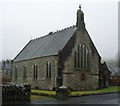
Parish of Liddesdale - Newcastleton Church
Built in 1888, the church is situated on Montagu Street near the site of the old railway station.
Image: © James Denham
Taken: 25 Jan 2011
0.17 miles


