IMAGES TAKEN NEAR TO
Jedbank Grove, JEDBURGH, TD8 6LN

Introduction

This page details the photographs taken nearby to Jedbank Grove, TD8 6LN by members of the Geograph project.

The Geograph project started in 2005 with the aim of publishing, organising and preserving representative images for every square kilometre of Great Britain, Ireland and the Isle of Man.

There are currently over 7.5m images from over14,400 individuals and you can help contribute to the project by visiting https://www.geograph.org.uk

Image Map


Images are licensed for reuse under creativecommons.org/licenses/by-sa/2.0
Notes
  • Clicking on the map will re-center to the selected point.
  • The higher the marker number, the further away the image location is from the centre of the postcode.

Image Listing (27 Images Found)

Images are licensed for reuse under creativecommons.org/licenses/by-sa/2.0
  • ...
Image
Details
Distance
1
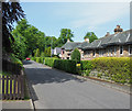
Houses along Sharplaw Road
Sharplaw Road, in a quiet residential area of Jedburgh.
Image: © Trevor Littlewood Taken: 26 May 2018
0.08 miles
2
Cliffs at Jedbank overlooking Jed Water, Jedburgh
Image: © Colin Park Taken: 6 Sep 2018
0.08 miles
3
Cliff overlooking the Jed Water
Spectacular old red sandstone cliff overlooking the Jed Water, within the built-up area of Jedburgh. The cliff is overhanging in parts, whilst the bole of an old tree clings to the top of the cliff.
Image: © Oliver Dixon Taken: 22 Jul 2014
0.08 miles
4
Devonian sandstone cliff, Jedburgh
A beautiful exposure of Devonian Upper Old Red Sandstone by the Jed Water, showing horizontal bedding laid down approximately 370 million years ago when Scotland was about 10 degrees S of the equator - see 'Death of an Ocean' by E Clarkson and B Upton (Dunedin, Edinburgh 2010) for more about Borders geology. There is a similar looking exposure by the Oxnam Water about 3km NE from here, shown in Image
Image: © Jim Barton Taken: 18 Nov 2012
0.08 miles
5
Riverside path and sandstone crags, Jed Water
Crags on the W side of the Jed Water where it has eroded through the Old Red Sandstone give an unexpectedly wild feel to the simple stroll along the other bank.
Image: © Jim Barton Taken: 23 Sep 2011
0.09 miles
6
Public Footpath along Jedwater
Image: © Bill Henderson Taken: 21 Jul 2014
0.10 miles
7
Waterside Walk, Jedburgh
Foot and cycle path along the Jed Water which flows between the grassy patch and the cliff on the opposite bank. The "W" logo on the post indicates the route of the Borders Abbeys Way, a long distance path in the Scottish Borders.
Image: © Oliver Dixon Taken: 22 Jul 2014
0.11 miles
8
Turf Zone "Jedbank"
Riverside walk at Jedburgh.
Image: © Ian S Taken: 3 Oct 2022
0.12 miles
9
Footbridge over Jed Water, Jedburgh
Image: © Ian S Taken: 3 Oct 2022
0.16 miles
10
Garages to the rear of Bongate Gardens, Jedburgh
Image: © Ian S Taken: 3 Oct 2022
0.16 miles
  • ...