IMAGES TAKEN NEAR TO
Yarrow Terrace, SELKIRK, TD7 5AR

Introduction

This page details the photographs taken nearby to Yarrow Terrace, TD7 5AR by members of the Geograph project.

The Geograph project started in 2005 with the aim of publishing, organising and preserving representative images for every square kilometre of Great Britain, Ireland and the Isle of Man.

There are currently over 7.5m images from over14,400 individuals and you can help contribute to the project by visiting https://www.geograph.org.uk

Image Map


Images are licensed for reuse under creativecommons.org/licenses/by-sa/2.0
Notes
  • Clicking on the map will re-center to the selected point.
  • The higher the marker number, the further away the image location is from the centre of the postcode.

Image Listing (90 Images Found)

Images are licensed for reuse under creativecommons.org/licenses/by-sa/2.0
  • ...
Image
Details
Distance
1
Temporary fencing at Victoria Park, Selkirk
Image: © Gordon Brown Taken: 12 Apr 2023
0.04 miles
2
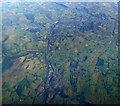
Selkirk and Galashiels from the air
Selkirk is in the foreground, Galashiels and Melrose in the distance. Taken by mobile phone, from a Prague bound flight from Edinburgh.
Image: © Thomas Nugent Taken: 10 Oct 2022
0.04 miles
3
Selkirk from the air
A break in the clouds reveals the industrial buildings alongside Ettrick Water. The footbridge at Bridge Street is at the bottom of the photo and the Linglie Footbridge is near the centre of the photo.
Image: © Thomas Nugent Taken: 27 Feb 2014
0.05 miles
4
Selkirk from the air
Looking over the entire town from an Amsterdam bound flight from Glasgow.
Image: © Thomas Nugent Taken: 2 Mar 2015
0.05 miles
5
Selkirk from the air
The Amsterdam bound aircraft (from Glasgow) is about to enter cloud.
Image: © Thomas Nugent Taken: 2 Mar 2015
0.05 miles
6
Selkirk
The road from Ettrickbridge heads in to town.
Image: © James Denham Taken: 7 Mar 2009
0.05 miles
7
Yarrow Terrace, Selkirk
A road to the town centre up from the Selkirk Bridge. The Sherriff Court building is prominent and the B7009 from Ettrickbridge joins from the right.
Image: © Jim Barton Taken: 24 Jan 2020
0.06 miles
8
Flood Protection Scheme completed, Selkirk
After the scheme has been completed paths, embankments and a flood wall border the Ettrick Water along with extensive reworking of the course of the Long Philip Burn.
Image: © Jim Barton Taken: 28 May 2017
0.06 miles
9
New footpath and embankment, Selkirk
Work for the flood protection scheme on the riverbank bordering Victoria Park.
Image: © Jim Barton Taken: 28 Oct 2015
0.07 miles
10
The Glen Hotel. Yarrow Terrace Selkirk
Our beds for the night on the Borders Abbey Way. The road to the right goes over Selkirk Bridge
Image: © Martin Dawes Taken: 9 Sep 2019
0.09 miles
  • ...