1
Deer Larder, Riddell House
According to the Canmore website at https://canmore.org.uk/site/55483/riddell this outbuilding by the old Riddell House was a deer larder.
Image: © Jim Barton
Taken: 1 Jul 2022
0.02 miles
2
Remains of the former Riddell House
The gaunt remains of the house, a roofless ruin with substantial tree growth within. The house is on the site of an old peel tower which might date back to the 14th century. The house was extended and changed over the years but burnt down in 1943 to leave this shell standing. Further details can be found on the Canmore website at https://canmore.org.uk/site/55483/riddell
Image: © Jim Barton
Taken: 1 Jul 2022
0.03 miles
3
Doorway to the former Riddell House
The doorway on the south side of the ruined house, destroyed by fire in 1943. It appears that a plaque or stone above the door has been removed. The ruin is of course fenced off as it is clearly in a potentially dangerous state.
For more details see the Canmore website at https://canmore.org.uk/site/55483/riddell.
Image: © Jim Barton
Taken: 1 Jul 2022
0.04 miles
4
A farm road on the Riddell Estate
This is Park Bridge which spans a small burn and culvert.
Image: © Walter Baxter
Taken: 11 Feb 2022
0.08 miles
5
Park Bridge, Riddell Estate
A bridge taking the track from Lilliesleaf across a tributary of the Ale Water. It is referred to as Park Bridge in the Canmore website entry for Riddell House: https://canmore.org.uk/site/55483/riddell.
Image: © Jim Barton
Taken: 1 Jul 2022
0.09 miles
6
Sheep grazing near Riddell
Estate land near the ruined house at Riddell. Left of centre is a stone bridge taking the track over a minor burn.
Image: © Jim Barton
Taken: 1 Jul 2022
0.15 miles
7
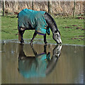
A horse reflection at Riddell
A large pond formed in this horse field after periods of heavy rain. I walked by here two days previously and there was no lying water in the field.
Image: © Walter Baxter
Taken: 14 Feb 2022
0.16 miles
8
Riddell West Lodge by the B6400 road
Image: © Walter Baxter
Taken: 12 Sep 2006
0.18 miles
9
Sheep pasture at Riddell
Viewed from the B6400 near Riddell West Lodge.
Image: © Walter Baxter
Taken: 17 Aug 2008
0.19 miles
10
Estate bridge over the Ale Water, Riddell
A closer view of the bridge shown in
Image It is subject to a 2-ton weight limit.
Image: © Jim Barton
Taken: 1 Jul 2022
0.20 miles


