IMAGES TAKEN NEAR TO
MELROSE, TD6 9ET
Introduction
This page details the photographs taken nearby to TD6 9ET by members of the Geograph project.
The Geograph project started in 2005 with the aim of publishing, organising and preserving representative images for every square kilometre of Great Britain, Ireland and the Isle of Man.

There are currently over 7.5m images from over14,400 individuals and you can help contribute to the project by visiting https://www.geograph.org.uk
Image Map
Images are licensed for reuse under creativecommons.org/licenses/by-sa/2.0
Notes
- Clicking on the map will re-center to the selected point.
- The higher the marker number, the further away the image location is from the centre of the postcode.
Image Listing (5 Images Found)
Images are licensed for reuse under creativecommons.org/licenses/by-sa/2.0
Image
Details
Distance
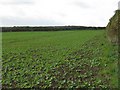
1
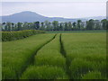
Tram lines in the barley
Near Wellrig Farm
Image: © James Denham
Taken: 30 May 2008
0.16 miles
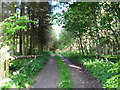
2
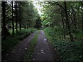
Currie's Wood
A track runs down the middle of a strip wood. A summer view: Image
Image: © Richard Webb
Taken: 14 Feb 2013
0.22 miles
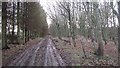
4
Currie's Wood
A track down the middle of a strip wood.
Image: © Richard Webb
Taken: 30 May 2007
0.24 miles