IMAGES TAKEN NEAR TO
Waverley Gardens, MELROSE, TD6 9AF

Introduction

This page details the photographs taken nearby to Waverley Gardens, TD6 9AF by members of the Geograph project.

The Geograph project started in 2005 with the aim of publishing, organising and preserving representative images for every square kilometre of Great Britain, Ireland and the Isle of Man.

There are currently over 7.5m images from over14,400 individuals and you can help contribute to the project by visiting https://www.geograph.org.uk

Image Map


Images are licensed for reuse under creativecommons.org/licenses/by-sa/2.0
Notes
  • Clicking on the map will re-center to the selected point.
  • The higher the marker number, the further away the image location is from the centre of the postcode.

Image Listing (90 Images Found)

Images are licensed for reuse under creativecommons.org/licenses/by-sa/2.0
  • ...
Image
Details
Distance
1
Darnick Community Garden
A pleasant little garden with a bench on a triangle of ground at the junction of Tower Road and Fishers Lane.
Image: © Jim Barton Taken: 16 Jun 2017
0.04 miles
2
Darnick Village
Viewed from Chiefswood Road with unusual cirrus uncinus clouds in the sky.
Image: © Walter Baxter Taken: 12 Sep 2005
0.05 miles
3
Smith Memorial Hall, Darnick
Image: © Ian S Taken: 4 Jan 2020
0.06 miles
4
Tower Road sign
A street sign on the stone wall outside Fisher's Tower in Darnick. For a view of the wall and Fisher's Tower, see Image
Image: © Walter Baxter Taken: 31 Mar 2008
0.07 miles
5
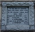
Darnick WW2 War Memorial
At Smith Memorial Hall on Abbotsford Road, Darnick.
Image: © Ian S Taken: 4 Jan 2020
0.07 miles
6
Darnick WW1 War Memorial
At Smith Memorial Hall on Abbotsford Road, Darnick.
Image: © Ian S Taken: 4 Jan 2020
0.07 miles
7
A corner of Darnick
Abbotsford Road, Darnick with the Eildon Hills above.
Image: © Jim Barton Taken: 30 Oct 2015
0.07 miles
8
Abbotsford Road
Abbotsford Road, Darnick. View to the Eildon Hills.
Image: © Richard Webb Taken: 29 Jun 2010
0.07 miles
9
The Huntly Burn, Darnick
Looking downstream from Tower Road. The burn joins the Tweed past the Waverley Castle Hotel.
Image: © Jim Barton Taken: 16 Jun 2017
0.07 miles
10
Fisher's Tower, Darnick
This ruined 16th century tower house stands in the grounds of Darnick Tower. There were originally three towers in the village but there is no sign today of the third tower. Viewed from Abbotsford Road with a street sign on the wall for Tower Road leading to Fishers Lane.
Image: © Walter Baxter Taken: 2 Apr 2008
0.07 miles
  • ...