IMAGES TAKEN NEAR TO
Springfield Terrace, MELROSE, TD6 0ER

Introduction

This page details the photographs taken nearby to Springfield Terrace, TD6 0ER by members of the Geograph project.

The Geograph project started in 2005 with the aim of publishing, organising and preserving representative images for every square kilometre of Great Britain, Ireland and the Isle of Man.

There are currently over 7.5m images from over14,400 individuals and you can help contribute to the project by visiting https://www.geograph.org.uk

Image Map


Images are licensed for reuse under creativecommons.org/licenses/by-sa/2.0
Notes
  • Clicking on the map will re-center to the selected point.
  • The higher the marker number, the further away the image location is from the centre of the postcode.

Image Listing (92 Images Found)

Images are licensed for reuse under creativecommons.org/licenses/by-sa/2.0
  • ...
Image
Details
Distance
1
Houses, St Boswells
Image: © JThomas Taken: 8 Sep 2016
0.08 miles
2
A car boot sale at St Boswells
This was held on The Green in ideal weather conditions. The Buccleuch Arms Hotel is in the background.
Image: © Walter Baxter Taken: 9 Sep 2012
0.09 miles
3
B6404 at St Boswells
Looking towards its junction with the A68.
Image: © M J Richardson Taken: 3 Oct 2009
0.10 miles
4
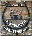
A blacksmith sign at St Boswells
This sign is on a storage building at a residential property in the village. The building at one time must have been a blacksmith’s workshop.
Image: © Walter Baxter Taken: 9 Oct 2013
0.10 miles
5
Tourist notice as approaching B6404 road junction
By A68, with St Boswells cricket ground off left.
Image: © Stanley Howe Taken: 14 May 2012
0.10 miles
6
St Boswells from the air
On the south bank of the meandering River Tweed. The line of the former Kelso branch line off the Waverley Line can be seen in the foreground. The Kelso branch closed to passengers on 15th June 1964, freight services continued until 1st April 1968.
Image: © Thomas Nugent Taken: 3 Dec 2018
0.11 miles
7
St Boswells
View across The Green.
Image: © Russel Wills Taken: 1 Sep 2021
0.11 miles
8
War Memorial, St. Boswells
Situated on the A68, note the Eildons in the background.
Image: © James Denham Taken: 9 Apr 2008
0.11 miles
9
St Boswells War Memorial
A Celtic cross on a boulder-cairn base (c.1920) on the west side of the A68. The Eildon Hills are in the background.
Image: © Walter Baxter Taken: 6 Nov 2007
0.11 miles
10
A road diversion sign at St Boswells
The A68 at Carter Bar was closed due to drifting snow and this sign was advising motorists to take the A699 Kelso road for an alternative route south.
Image: © Walter Baxter Taken: 26 Jan 2013
0.11 miles
  • ...