IMAGES TAKEN NEAR TO
Grangeburn Close, BERWICK-UPON-TWEED, TD15 2YG
Introduction
This page details the photographs taken nearby to Grangeburn Close, TD15 2YG by members of the Geograph project.
The Geograph project started in 2005 with the aim of publishing, organising and preserving representative images for every square kilometre of Great Britain, Ireland and the Isle of Man.

There are currently over 7.5m images from over14,400 individuals and you can help contribute to the project by visiting https://www.geograph.org.uk
Image Map
Images are licensed for reuse under creativecommons.org/licenses/by-sa/2.0
Notes
- Clicking on the map will re-center to the selected point.
- The higher the marker number, the further away the image location is from the centre of the postcode.
Image Listing (12 Images Found)
Images are licensed for reuse under creativecommons.org/licenses/by-sa/2.0
Image
Details
Distance
4
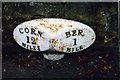
Old Milepost by the B6435, Cornhill Road, East Ord
Cast iron post by the B6435 (was A1), in parish of Ord (Berwick upon Tweed District), by Homelea, Cornhill Road, East Ord, back to footpath, on South side of road. Patterson twin ovals iron post, erected by the Deanburn Bridge, Berwick, Cornhill turnpike trust in the 19th century.
Inscription reads:-
: CORN / 12 / MILES : : BER / 1 / MILE :
Maker:-
: SMITH PATTERSON / BLAYDON :
Milestone Society National ID: NB_BWCH01
Image: © IA Davison
Taken: 11 Nov 2004
0.16 miles
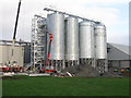
6
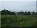
Maltings across the field
The large Simpsons Malt site can be seen across the field.
Image: © Graham Robson
Taken: 3 May 2012
0.22 miles
7
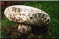
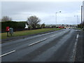
Old Milepost by the B6354, Etal Road, Ord parish
Cast iron post by the B6354, in parish of ORD (BERWICK UPON TWEED District), Mansefield Road junction with Etal Road, East Ord, on wide cut grass verge, on North side of road. Patterson twin ovals iron post, erected by the Deanburn Bridge, Berwick, Cornhill turnpike trust in the 19th century.
Inscription reads:-
: BER / 1 / MILE : : ETAL / 9 / MILES :
Maker:-
: SMITH PATTERSON / BLAYDON :
Northumberland HER.
Reference number: N16850 https://www.heritagegateway.org.uk/Gateway/Results_Single.aspx?uid=N16850&resourceID=110
Milestone Society National ID: NB_BWET01.
Image: © IA Davison
Taken: 11 Nov 2004
0.23 miles
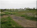
9
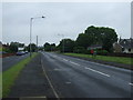
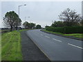
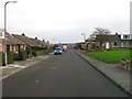
Etal Road (B6354)
Heading north towards Berwick.
Image: © JThomas
Taken: 30 Apr 2015
0.23 miles