IMAGES TAKEN NEAR TO
GALASHIELS, TD1 2QB
Introduction
This page details the photographs taken nearby to TD1 2QB by members of the Geograph project.
The Geograph project started in 2005 with the aim of publishing, organising and preserving representative images for every square kilometre of Great Britain, Ireland and the Isle of Man.

There are currently over 7.5m images from over14,400 individuals and you can help contribute to the project by visiting https://www.geograph.org.uk
Image Map
Images are licensed for reuse under creativecommons.org/licenses/by-sa/2.0
Notes
- Clicking on the map will re-center to the selected point.
- The higher the marker number, the further away the image location is from the centre of the postcode.
Image Listing (12 Images Found)
Images are licensed for reuse under creativecommons.org/licenses/by-sa/2.0
Image
Details
Distance
1
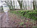
Mossed-over wall on Allanshaws near Lauder
Image: © ian shiell
Taken: 20 Nov 2019
0.02 miles
2
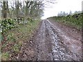
Steep farm track on Allanshaws near Lauder in the Scottish Borders
Image: © ian shiell
Taken: 20 Nov 2019
0.03 miles
3
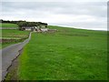
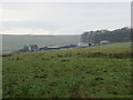
Allanshaws
Hillfarm set amongst big grass fields beneath Sell Moor Hill.
Image: © Richard Webb
Taken: 7 Oct 2006
0.04 miles
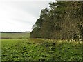
4
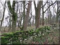
Mature woodland strip on Allanshaws near Lauder in the Scottish Borders
Image: © ian shiell
Taken: 20 Nov 2019
0.05 miles
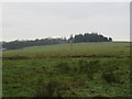
5
Allanshaws above Lauder in the Scottish Borders
Image: © ian shiell
Taken: 20 Nov 2019
0.06 miles
6
Woodland above Allanshaws near Lauder in the Scottish Borders
Image: © ian shiell
Taken: 20 Nov 2019
0.08 miles
7
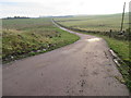
Road from Allanshaws near Lauder in the Scottish Borders
Image: © ian shiell
Taken: 20 Nov 2019
0.12 miles
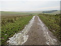
8
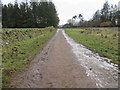
Icy track leading to Allanshaws near Lauder in the Scottish Borders
Image: © ian shiell
Taken: 20 Nov 2019
0.13 miles
9
Icy track above Allanshaws Farm near Lauder in the Scottish Borders
Image: © ian shiell
Taken: 20 Nov 2019
0.14 miles
10
View from woodland strip over Allan Water towards Allanshaws near Lauder
Image: © ian shiell
Taken: 7 Nov 2020
0.14 miles