IMAGES TAKEN NEAR TO
GALASHIELS, TD1 2PW
Introduction
This page details the photographs taken nearby to TD1 2PW by members of the Geograph project.
The Geograph project started in 2005 with the aim of publishing, organising and preserving representative images for every square kilometre of Great Britain, Ireland and the Isle of Man.

There are currently over 7.5m images from over14,400 individuals and you can help contribute to the project by visiting https://www.geograph.org.uk
Image Map (Loading...)


Getting Data...Please wait
Leaflet Map data © OpenStreetMap
Images are licensed for reuse under creativecommons.org/licenses/by-sa/2.0
Notes
- Clicking on the map will re-center to the selected point.
- The higher the marker number, the further away the image location is from the centre of the postcode.
Image Listing (13 Images Found)
Images are licensed for reuse under creativecommons.org/licenses/by-sa/2.0
Image
Details
Distance
1
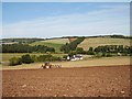
Cuddyhall
Ploughing in Lauderdale, the house is Cuddyhall.
Image: © Richard Webb
Taken: 15 Sep 2006
0.05 miles
2
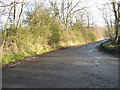
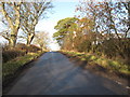
Road Junction at Blainslie
Junction leading to the A68
Image: © James Denham
Taken: 13 Jan 2009
0.14 miles
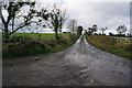
3
Minor road heading towards Earlston
Leading away from Blainslie.
Image: © James Denham
Taken: 13 Jan 2009
0.15 miles
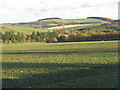
4
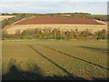
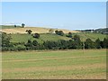
Fields in Lauderdale
Looking east towards Galadean.
Image: © M J Richardson
Taken: 2 Nov 2012
0.15 miles
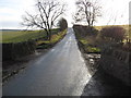
5
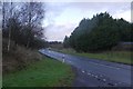
Minor road at Blainslie
In the Scottish Borders.
Image: © James Denham
Taken: 13 Jan 2009
0.16 miles
6
Next year's crop
While much of this years arable crops await harvesting in what to now has been good weather, next year's cereals are putting in an appearance.
Image: © Richard Webb
Taken: 3 Sep 2013
0.16 miles
8
Major road leading away from Earlston
The A68 between Lauder and Earlston on a very wet afternoon. Next stop: The Flat Cat for coffee.
Image: © Richard Webb
Taken: 26 Jan 2016
0.19 miles
10
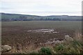
Lauderdale landscape
Looking southeast towards Earlston.
Image: © M J Richardson
Taken: 2 Nov 2012
0.24 miles