
IMAGES TAKEN NEAR TO
Langlee Drive, GALASHIELS, TD1 2EB
Introduction
This page details the photographs taken nearby to Langlee Drive, TD1 2EB by members of the Geograph project.
The Geograph project started in 2005 with the aim of publishing, organising and preserving representative images for every square kilometre of Great Britain, Ireland and the Isle of Man.

There are currently over 7.5m images from over14,400 individuals and you can help contribute to the project by visiting https://www.geograph.org.uk
Image Map
Images are licensed for reuse under creativecommons.org/licenses/by-sa/2.0
Notes
- Clicking on the map will re-center to the selected point.
- The higher the marker number, the further away the image location is from the centre of the postcode.
Image Listing (144 Images Found)
Images are licensed for reuse under creativecommons.org/licenses/by-sa/2.0
Image
Details
Distance
1
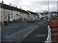
Langlee Drive, Galashiels
A residential area off the B6374 Melrose Road.
Image: © Jim Barton
Taken: 13 Jan 2023
0.01 miles
2

The Eildon Hills and Borders Railway
The line to Tweedbank from the footbridge to Netherdale on the east side of Galashiels.
Image: © Jim Barton
Taken: 24 Feb 2017
0.03 miles
3

The Borders Railway, Langlee
The line to Tweedbank seen from a footbridge, backed by the distinctive skyline of the Eildon Hills.
Image: © Jim Barton
Taken: 13 Jan 2023
0.04 miles
4
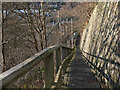
Steps down to railway bridge, Langlee
Steps down from Langlee Drive to bridges over the railway and the Gala Water.
Image: © Jim Barton
Taken: 13 Jan 2023
0.05 miles
5
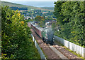
Waverley Line Steam Special
In September & October 2015, on the re-opening of the Waverley line between Edinburgh and Tweedbank, 3 steam specials per week were operated, all of them fully booked well in advance. This train is approaching Galashiels on the return journey to Edinburgh. Locomotive 60009, Union of South Africa, pulls the trains on the outward journey. As there are no turning facilities at Tweedbank, the return trip is hauled by a vintage diesel locomotive.
Image: © Mary and Angus Hogg
Taken: 23 Sep 2015
0.06 miles
6

Steps at Langlee, Galashiels
These steps lead from the footpath called the Black Path up to the Langlee housing scheme at Langlee Drive.
Image: © Walter Baxter
Taken: 7 Jan 2010
0.06 miles
7

Walking by the River Gala
A walker is exercising a dog on the north bank of the river at Netherdale.
Image: © Walter Baxter
Taken: 17 Feb 2008
0.06 miles
8

Gala Water flowing through Netherdale, Galashiels
The wall on the right is part of a flood defence scheme opened in 2014
Image: © Tim Heaton
Taken: 18 Jul 2017
0.06 miles
9

The Netherdale Cauld
This weir was integral in powering many of the tweed mills along the Gala Water
Image: © Iain Lees
Taken: 14 May 2009
0.07 miles
10
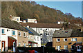
Housing at Langlee, Galashiels
These houses were viewed from Langlee Drive.
Image: © Walter Baxter
Taken: 8 Dec 2015
0.07 miles