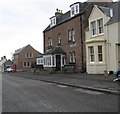
IMAGES TAKEN NEAR TO
Main Street, DUNS, TD11 3JH

Introduction

This page details the photographs taken nearby to Main Street, TD11 3JH by members of the Geograph project.

The Geograph project started in 2005 with the aim of publishing, organising and preserving representative images for every square kilometre of Great Britain, Ireland and the Isle of Man.

There are currently over 7.5m images from over14,400 individuals and you can help contribute to the project by visiting https://www.geograph.org.uk

Image Map


Images are licensed for reuse under creativecommons.org/licenses/by-sa/2.0
Notes
  • Clicking on the map will re-center to the selected point.
  • The higher the marker number, the further away the image location is from the centre of the postcode.

Image Listing (35 Images Found)

Images are licensed for reuse under creativecommons.org/licenses/by-sa/2.0
  • ...
Image
Details
Distance
1
Houses on Main Street, Swinton
Image: © JThomas Taken: 5 May 2016
0.02 miles
2
Telephone box on Main Street, Swinton
Image: © JThomas Taken: 5 May 2016
0.02 miles
3
The Wheatsheaf Hotel, Swinton
On Main Street.
Image: © JThomas Taken: 5 May 2016
0.02 miles
4
Wheatsheaf Hotel, Swinton
Overlooking the village green. https://eatdrinkstaywheatsheaf.com/
Image: © Russel Wills Taken: 11 Jul 2019
0.03 miles
5
The Wheatsheaf Hotel in Swinton
The hotel on the left is situated in Main Street. Viewed from the village green in early March.
Image: © Walter Baxter Taken: 12 Mar 2009
0.03 miles
6
Main Street, Swinton
Image: © Richard Webb Taken: 3 Jan 2011
0.03 miles
7
The Wheatsheaf Hotel in Swinton, Berwickshire
A very popular venue for locals and travellers alike.
Image: © James Denham Taken: 28 Mar 2013
0.04 miles
8
Swinton, by Duns
A view of the houses across The Green in the village of Swinton, by Duns, in the Scottish Borders.
Image: © Jerzy Morkis Taken: 2 Jul 2018
0.05 miles
9
Swinton Village Green
A picturesque village south of Duns with many fine cottages and a large village green with the remains of an ancient Cross at its centre.
Image: © Kevin Rae Taken: 10 Jul 2006
0.05 miles
10
The Green at Swinton
The village was planned around this rectangular green where the village cross (1769) stands. The prominent building on the left is the former Free Church (1860) now used as the village hall, but closed to the public at present. The name Swinton probably comes from 'Swine Town' from the days when there were lots of wild boars (pigs or swine) in the area. (Source: Swinton Kirk information leaflet).
Image: © Walter Baxter Taken: 12 Mar 2009
0.05 miles
  • ...