IMAGES TAKEN NEAR TO
Greenlaw, DUNS, TD10 6YW

Introduction

This page details the photographs taken nearby to TD10 6YW by members of the Geograph project.

The Geograph project started in 2005 with the aim of publishing, organising and preserving representative images for every square kilometre of Great Britain, Ireland and the Isle of Man.

There are currently over 7.5m images from over14,400 individuals and you can help contribute to the project by visiting https://www.geograph.org.uk

Image Map


Images are licensed for reuse under creativecommons.org/licenses/by-sa/2.0
Notes
  • Clicking on the map will re-center to the selected point.
  • The higher the marker number, the further away the image location is from the centre of the postcode.

Image Listing (10 Images Found)

Images are licensed for reuse under creativecommons.org/licenses/by-sa/2.0
Image
Details
Distance
1
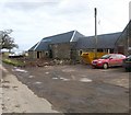
Farm building at Cothill
Image: © James Denham Taken: 3 Mar 2009
0.04 miles
2
Farm buildings being converted to homes at Cothill
Image: © James Denham Taken: 3 Mar 2009
0.05 miles
3
Minor road at Cothill
Image: © Steven Brown Taken: 21 May 2022
0.06 miles
4
Snowdrops, Cothill
A bit of coppicing.
Image: © Richard Webb Taken: 5 Feb 2006
0.08 miles
5
Marchmont Doocot
This circular doocot was built by James Williamson in 1749. It stands at the end of an avenue, 1.8km northeast of Marchmont House.
Image: © Walter Baxter Taken: 19 Apr 2009
0.08 miles
6
Looking towards fascinating building situated on grazing land at Cothill
I am not certain but I believe this to be a form of dovecote. It was probably part of the Marchmont estate nearby.
Image: © James Denham Taken: 3 Mar 2009
0.10 miles
7
Folly or Doocot, Cothill
At the end of a long avenue of trees from Marchmont House. Folly? It's on the line, but the wood and this aspect belong to NT7649.
Image: © Richard Webb Taken: 5 Feb 2006
0.13 miles
8
A signpost for Marchmont
Near Cothill and signposted 1 mile along Marchmont Avenue to Marchmont House.
Image: © Walter Baxter Taken: 19 Apr 2009
0.15 miles
9
Downhill From Here
The rough track between Polwarth Rhodes and Cothill heads down and over the Kirk Burn, before winding back up to Cothill, just visible in the distance.
Image: © James T M Towill Taken: 1 May 2015
0.18 miles
10
Kirk Burn
Dammed to form fish pools.
Image: © Richard Webb Taken: 5 Feb 2006
0.23 miles