IMAGES TAKEN NEAR TO
Perry Road, HIGHBRIDGE, TA9 4AY
Introduction
This page details the photographs taken nearby to Perry Road, TA9 4AY by members of the Geograph project.
The Geograph project started in 2005 with the aim of publishing, organising and preserving representative images for every square kilometre of Great Britain, Ireland and the Isle of Man.

There are currently over 7.5m images from over14,400 individuals and you can help contribute to the project by visiting https://www.geograph.org.uk
Image Map
Images are licensed for reuse under creativecommons.org/licenses/by-sa/2.0
Notes
- Clicking on the map will re-center to the selected point.
- The higher the marker number, the further away the image location is from the centre of the postcode.
Image Listing (9 Images Found)
Images are licensed for reuse under creativecommons.org/licenses/by-sa/2.0
Image
Details
Distance
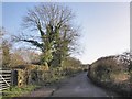
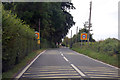
4
Perry Road
Road junction at Perry Farm.
Image: © Adrian and Janet Quantock
Taken: 5 Feb 2006
0.14 miles
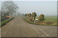
5
Mark College
Some of the older buildings of the college (formerly Mark House), which specialises in pupils with learning difficulties.
Image: © Neil Owen
Taken: 11 May 2019
0.15 miles
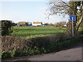
6
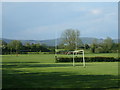
Mark College playing fields
Academia and athleticism in the village.
Image: © Neil Owen
Taken: 11 May 2019
0.19 miles