IMAGES TAKEN NEAR TO
Caxton Drive, HIGHBRIDGE, TA9 3GF
Introduction
This page details the photographs taken nearby to Caxton Drive, TA9 3GF by members of the Geograph project.
The Geograph project started in 2005 with the aim of publishing, organising and preserving representative images for every square kilometre of Great Britain, Ireland and the Isle of Man.

There are currently over 7.5m images from over14,400 individuals and you can help contribute to the project by visiting https://www.geograph.org.uk
Image Map
Images are licensed for reuse under creativecommons.org/licenses/by-sa/2.0
Notes
- Clicking on the map will re-center to the selected point.
- The higher the marker number, the further away the image location is from the centre of the postcode.
Image Listing (83 Images Found)
Images are licensed for reuse under creativecommons.org/licenses/by-sa/2.0
Image
Details
Distance
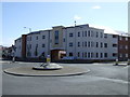
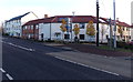
1

Recently-built flats in Highbridge
On the corner of Church Street and Caxton Road, built in 2011-2012.
Image: © Jaggery
Taken: 10 Dec 2014
0.02 miles
3
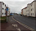
End of cycle route, Caxton Road, Highbridge
The A38 Church Street is behind the camera. An Asda superstore is ahead.
Image: © Jaggery
Taken: 10 Dec 2014
0.03 miles
4
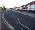
Long bus stop in Highbridge
Extending for 40 metres (130 feet) alongside the A38 Church Street.
Image: © Jaggery
Taken: 10 Dec 2014
0.04 miles
5
Year stone near recently built houses in Highbridge
Facing the A38, the year 2010 is inscribed on the stone on the right.
Image: © Jaggery
Taken: 10 Dec 2014
0.04 miles
6
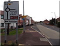
Directions sign alongside the A38 in Highbridge
On the approach to a crossroads roundabout.
Image: © Jaggery
Taken: 10 Dec 2014
0.04 miles
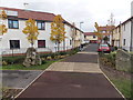
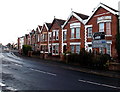
7
Modern housing alongside the A38 in Highbridge
Built c2010.
Image: © Jaggery
Taken: 10 Dec 2014
0.04 miles
8
Unsuitable route for heavy goods vehicles, Highbridge
Near the corner of Fairford Road and Worston Road, viewed from the edge of the A38.
Image: © Jaggery
Taken: 10 Dec 2014
0.05 miles
9
Zigzag roof pattern in Highbridge
Viewed across the A38 Church Street. Left for Bristol, right for Bridgwater.
Image: © Jaggery
Taken: 10 Dec 2014
0.05 miles
10
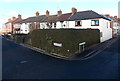
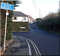
Corner hedge, Highbridge
On the corner of Fairford Road (left) and Worston Road, near the A38 junction.
Image: © Jaggery
Taken: 10 Dec 2014
0.05 miles