IMAGES TAKEN NEAR TO
Burnham Road, HIGHBRIDGE, TA9 3EQ

Introduction

This page details the photographs taken nearby to Burnham Road, TA9 3EQ by members of the Geograph project.

The Geograph project started in 2005 with the aim of publishing, organising and preserving representative images for every square kilometre of Great Britain, Ireland and the Isle of Man.

There are currently over 7.5m images from over14,400 individuals and you can help contribute to the project by visiting https://www.geograph.org.uk

Image Map


Images are licensed for reuse under creativecommons.org/licenses/by-sa/2.0
Notes
  • Clicking on the map will re-center to the selected point.
  • The higher the marker number, the further away the image location is from the centre of the postcode.

Image Listing (11 Images Found)

Images are licensed for reuse under creativecommons.org/licenses/by-sa/2.0
Image
Details
Distance
1
Burnham Stores
On Burnham Road. Showing position of Postbox No. TA9 221. See Image] for postbox.
Image: © JThomas Taken: 12 Jul 2019
0.06 miles
2
George VI postbox on Burnham Road, Highbridge
Postbox No. TA9 221. See Image] for context.
Image: © JThomas Taken: 12 Jul 2019
0.06 miles
3
Houses on Burnham Road (B3139), Highbridge
Image: © JThomas Taken: 12 Jul 2019
0.10 miles
4
Houses on Burnham Road (B3139), Highbridge
Image: © JThomas Taken: 12 Jul 2019
0.20 miles
5
Mini roundabout on Burnham Road (B3139), Highbridge
Image: © JThomas Taken: 12 Jul 2019
0.21 miles
6
Just in case
Apex Park is a former clay and brick works. The remaining pits were turned into lakes and are now a popular country park, covering some 42 acres. The lakes are pretty deep in places and hence the need for lifebelts.
Image: © Neil Owen Taken: 13 Aug 2013
0.22 miles
7
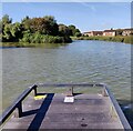
Lake Near Highbridge
Taken from Sustrans Cycle route 33
Image: © Geoff Pick Taken: 7 Aug 2009
0.23 miles
8
Grade II listed Huish, Highbridge
Mid 18th century house, perhaps the site of the manor house of the small local manor of Huish. Grade II listed in 1985. Out of shot, an oval plaque http://www.geograph.org.uk/photo/4303537 states that Huish was mentioned in the Domesday Book (1086).
Image: © Jaggery Taken: 10 Dec 2014
0.24 miles
9
Lake at the Apex Leisure and Wildlife Park
The park was created on the site of a former clay pit and brickwork manufacturing site, it covers 42 acres (17 ha).
Image: © Mat Fascione Taken: 20 Sep 2021
0.24 miles
10
Path and lake at the Apex Leisure and Wildlife Park
The park was created on the site of a former clay pit and brickwork manufacturing site, it covers 42 acres (17 ha).
Image: © Mat Fascione Taken: 20 Sep 2021
0.24 miles