
IMAGES TAKEN NEAR TO
Westfield Court, BURNHAM-ON-SEA, TA8 2DW
Introduction
This page details the photographs taken nearby to Westfield Court, TA8 2DW by members of the Geograph project.
The Geograph project started in 2005 with the aim of publishing, organising and preserving representative images for every square kilometre of Great Britain, Ireland and the Isle of Man.

There are currently over 7.5m images from over14,400 individuals and you can help contribute to the project by visiting https://www.geograph.org.uk
Image Map
Images are licensed for reuse under creativecommons.org/licenses/by-sa/2.0
Notes
- Clicking on the map will re-center to the selected point.
- The higher the marker number, the further away the image location is from the centre of the postcode.
Image Listing (72 Images Found)
Images are licensed for reuse under creativecommons.org/licenses/by-sa/2.0
Image
Details
Distance
1
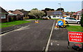
Westfield Court, Burnham-on-Sea
Part of the Westfield Court footway is closed during Wales & West Utilities underground gas pipe replacement work in May 2016.
Image: © Jaggery
Taken: 12 May 2016
0.01 miles
2
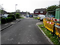
Rectory Lawn, Burnham-on-Sea
Cul-de-sac on the west side of Westfield Drive.
Image: © Jaggery
Taken: 12 May 2016
0.03 miles
3
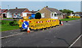
Yellow temporary barriers on the Westfield Drive pavement, Burnham-on-Sea
Barriers enclosing a hole in the ground during Wales & West Utilities gas pipe replacement work in May 2016.
Image: © Jaggery
Taken: 12 May 2016
0.03 miles
4
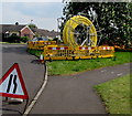
Yellow coil, Westfield Drive, Burnham-on-Sea
The coil of new gas pipes will replace old underground metal gas pipes
during Wales & West Utilities infrastructure upgrade work in May 2016.
Image: © Jaggery
Taken: 12 May 2016
0.05 miles
5
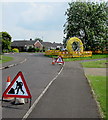
Temporary road signs, Westfield Drive, Burnham-on-Sea
On the approach to Wales & West Utilities infrastructure upgrade work in May 2016.
A yellow coil http://www.geograph.org.uk/photo/5606986 of new gas pipes is in the background.
Image: © Jaggery
Taken: 12 May 2016
0.05 miles
6
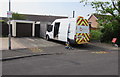
Wales & West Utilities van, Westfield Drive, Burnham-on-Sea
Viewed in May 2016 during Wales & West Utilities gas pipe replacement work in the area.
Image: © Jaggery
Taken: 12 May 2016
0.05 miles
7
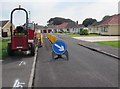
Thwaites dumper, Westfield Drive, Burnham-on-Sea
Viewed in May 2016 during Wales & West Utilities gas pipe replacement work in the area.
Image: © Jaggery
Taken: 12 May 2016
0.06 miles
8
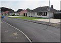
Westfield Drive bungalows, Burnham-on-Sea
Originally, bungalow was used in English for a lightly-built house, with a veranda and one storey.
In current UK usage it is a convenient word for any one-storey dwelling.
Image: © Jaggery
Taken: 12 May 2016
0.08 miles
9
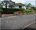
Westfield Drive fence and hedge, Burnham-on-Sea
Viewed from the corner of Rectory Road.
Image: © Jaggery
Taken: 12 May 2016
0.08 miles
10
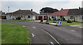
Bungalows opposite a bend in Westfield Drive, Burnham-on-Sea
Originally, bungalow was used in English for a lightly-built house, with a veranda and one storey.
In current UK usage it is a convenient word for any one-storey dwelling.
Image: © Jaggery
Taken: 12 May 2016
0.09 miles