IMAGES TAKEN NEAR TO
Little Leaze Lane, BRIDGWATER, TA7 9HJ
Introduction
This page details the photographs taken nearby to Little Leaze Lane, TA7 9HJ by members of the Geograph project.
The Geograph project started in 2005 with the aim of publishing, organising and preserving representative images for every square kilometre of Great Britain, Ireland and the Isle of Man.

There are currently over 7.5m images from over14,400 individuals and you can help contribute to the project by visiting https://www.geograph.org.uk
Image Map
Images are licensed for reuse under creativecommons.org/licenses/by-sa/2.0
Notes
- Clicking on the map will re-center to the selected point.
- The higher the marker number, the further away the image location is from the centre of the postcode.
Image Listing (8 Images Found)
Images are licensed for reuse under creativecommons.org/licenses/by-sa/2.0
Image
Details
Distance
4
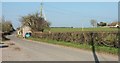
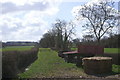
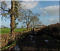
The Nydon, Catcott
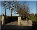
From the entrance to the car park for Image], with Bowden Cottage a short way along the lane.
Image: © Derek Harper
Taken: 13 Mar 2016
0.15 miles
7
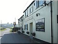
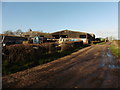
The Crown Inn, Catcott
The pub is out of town, as it were, along The Nydon.
Image: © Derek Harper
Taken: 13 Mar 2016
0.16 miles
8
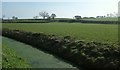
Field by Nidon Rhyne
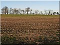
The beginnings of the Polden Hills, gently rising from the Somerset Levels.
Image: © Derek Harper
Taken: 13 Mar 2016
0.17 miles