IMAGES TAKEN NEAR TO
Stawell, BRIDGWATER, TA7 9AN
Introduction
This page details the photographs taken nearby to TA7 9AN by members of the Geograph project.
The Geograph project started in 2005 with the aim of publishing, organising and preserving representative images for every square kilometre of Great Britain, Ireland and the Isle of Man.

There are currently over 7.5m images from over14,400 individuals and you can help contribute to the project by visiting https://www.geograph.org.uk
Image Map
Images are licensed for reuse under creativecommons.org/licenses/by-sa/2.0
Notes
- Clicking on the map will re-center to the selected point.
- The higher the marker number, the further away the image location is from the centre of the postcode.
Image Listing (18 Images Found)
Images are licensed for reuse under creativecommons.org/licenses/by-sa/2.0
Image
Details
Distance
8

Fruit-Honey Farm
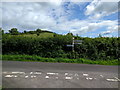
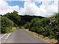
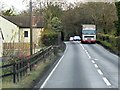
An ununsually named farmhouse in Innsmead Lane, nestling below the ridge of the Polden Hills. The house is a relatively new build, replacing an older one.
Image: © Neil Owen
Taken: 3 Apr 2021
0.18 miles
9
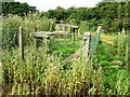
ROC (?) Post
Close to the trig point, somewhat overgrown
Image: © Damon Knight
Taken: 1 Sep 2007
0.18 miles
10
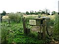
ROC(?) Post Second View
Second view from the east
Image: © Damon Knight
Taken: 1 Sep 2007
0.18 miles