IMAGES TAKEN NEAR TO
Saltmoor, BRIDGWATER, TA7 0RW
Introduction
This page details the photographs taken nearby to Saltmoor, TA7 0RW by members of the Geograph project.
The Geograph project started in 2005 with the aim of publishing, organising and preserving representative images for every square kilometre of Great Britain, Ireland and the Isle of Man.

There are currently over 7.5m images from over14,400 individuals and you can help contribute to the project by visiting https://www.geograph.org.uk
Image Map
Images are licensed for reuse under creativecommons.org/licenses/by-sa/2.0
Notes
- Clicking on the map will re-center to the selected point.
- The higher the marker number, the further away the image location is from the centre of the postcode.
Image Listing (14 Images Found)
Images are licensed for reuse under creativecommons.org/licenses/by-sa/2.0
Image
Details
Distance
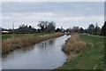
2
Retaining wall along the River Parrett
Image: © Sarah Charlesworth
Taken: 15 Jun 2010
0.11 miles
5
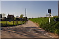
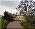
Burrowbridge : Saltmoor
A small lane known as Saltmoor heading out of Burrowbridge.
Image: © Lewis Clarke
Taken: 13 Apr 2014
0.12 miles
6
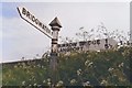
Direction Sign - Signpost at Manor Farm, Burrowbridge
Pyramid finial - 2 arms; Somerset SCC pyramid by the UC road, in parish of Burrowbridge (Taunton Deane District), on the northeast side of the T junction of lanes to Burrowbridge and Moorland at Manor Farm.
surveyed
Milestone Society National ID: SO_ST3431
Image: © Milestone Society
Taken: Unknown
0.13 miles
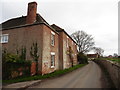
8

Taunton Deane District : Grassy Field & Horses
Horses in a grassy field in the Taunton Deane District.
Image: © Lewis Clarke
Taken: 13 Apr 2014
0.17 miles
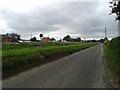
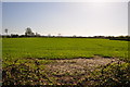
9
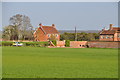
Taunton Deane District : Grassy Field
Looking across a grassy field and towards Saltmoor House.
Image: © Lewis Clarke
Taken: 13 Apr 2014
0.19 miles
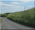
10
Burrowbridge : Grassy Field
A grassy field on the outskirts of Burrowbridge.
Image: © Lewis Clarke
Taken: 13 Apr 2014
0.19 miles