1
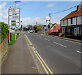
West along Crestfield Avenue, Bridgwater
From the Western Way end of Crestfield Avenue looking in the direction of Carlton Drive.
Image: © Jaggery
Taken: 3 Apr 2017
0.01 miles
2
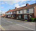
Crestfield Avenue houses, Bridgwater
At the northeast end of Crestfield Avenue, near Western Way.
Image: © Jaggery
Taken: 3 Apr 2017
0.02 miles
3
Viridor lorry in the north of Bridgwater
Stopped at traffic lights on the A39 Western Way at the Chilton Street crossroads.
Viridor's business is the transformation of waste into recyclables, raw materials and energy.
Viridor's head office is Viridor House http://www.geograph.org.uk/photo/4282433 in Youngman Place, Priory Bridge Road, Taunton.
Image: © Jaggery
Taken: 3 Apr 2017
0.03 miles
4
Small gas installation alongside Western Way, Bridgwater
The small green cabinet is a Wales & West Utilities gas installation
located on the grass between Western Way and Crestfield Avenue.
Image: © Jaggery
Taken: 3 Apr 2017
0.03 miles
5
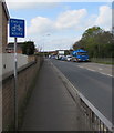
End of cycle route sign, Western Way, Bridgwater
Alongside the A39 Western Way near the Chilton Street crossroads.
The approaching blue lorry is part of the Viridor fleet. http://www.geograph.org.uk/photo/5337512
Image: © Jaggery
Taken: 3 Apr 2017
0.03 miles
6
Queen Elizabeth II pillarbox and a Royal Mail drop box in Bridgwater
Alongside Chilton Street near this http://www.geograph.org.uk/photo/5337575 directions sign.
Image: © Jaggery
Taken: 3 Apr 2017
0.03 miles
7
Wire over crossroads in the north of Bridgwater
At the intersection of the A39 Western Way and Chilton Street.
Image: © Jaggery
Taken: 3 Apr 2017
0.04 miles
8
Directions sign facing Chilton Street, Bridgwater
On the southern approach to the A39 Western Way crossroads. G'bury is Glastonbury.
Image: © Jaggery
Taken: 3 Apr 2017
0.04 miles
9
Ordnance Survey Cut Mark
This OS cut mark can be found on No149 Chiltern Street. It marks a point 6.852m above mean sea level.
Image: © Adrian Dust
Taken: 16 Jan 2023
0.04 miles
10
Row of six houses, Chilton Street, Bridgwater
On the east side of Chilton Street on the southern approach to the A39 Western Way crossroads.
Image: © Jaggery
Taken: 3 Apr 2017
0.04 miles


