IMAGES TAKEN NEAR TO
Reedmoor Gardens, BRIDGWATER, TA6 3SL
Introduction
This page details the photographs taken nearby to Reedmoor Gardens, TA6 3SL by members of the Geograph project.
The Geograph project started in 2005 with the aim of publishing, organising and preserving representative images for every square kilometre of Great Britain, Ireland and the Isle of Man.

There are currently over 7.5m images from over14,400 individuals and you can help contribute to the project by visiting https://www.geograph.org.uk
Image Map
Images are licensed for reuse under creativecommons.org/licenses/by-sa/2.0
Notes
- Clicking on the map will re-center to the selected point.
- The higher the marker number, the further away the image location is from the centre of the postcode.
Image Listing (36 Images Found)
Images are licensed for reuse under creativecommons.org/licenses/by-sa/2.0
Image
Details
Distance
1
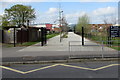
Entrance to Trinity Sports & Leisure centre, Bridgwater
From the west side of Chilton Street in the north of Bridgwater.
The centre's facilities include a 45-station fitness studio, an exercise studio,
a 4-court sports hall and a 6-lane swimming pool with a pool for learners.
Image: © Jaggery
Taken: 3 Apr 2017
0.13 miles
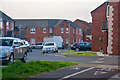
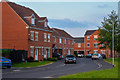
2
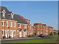
Housing development on the Northern Distributor Road (2005)
Image: © Ken Grainger
Taken: 11 Oct 2008
0.15 miles
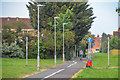
3
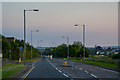
Bridgwater : Homberg Way A39
Looking along Homberg Way as it heads through Bridgwater.
Image: © Lewis Clarke
Taken: 22 May 2018
0.17 miles
4
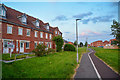
Bridgwater : Footpath
Looking along a footpath through the housing estate.
Image: © Lewis Clarke
Taken: 22 May 2018
0.19 miles
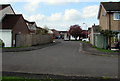
5
Bridgwater : Verona Court
Looking along Verona Court in Bridgwater.
Image: © Lewis Clarke
Taken: 22 May 2018
0.19 miles
6
Bridgwater : Footpath
A footpath heading through a housing estate.
Image: © Lewis Clarke
Taken: 22 May 2018
0.19 miles
7
West along Crestfield Avenue, Bridgwater
From the Western Way end of Crestfield Avenue looking in the direction of Carlton Drive.
Image: © Jaggery
Taken: 3 Apr 2017
0.19 miles
8
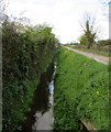
Rhyne below Chilton Moor Lane, Bridgwater
Viewed from the west side of Chilton Road at the northern edge of Bridgwater.
Rhyne is the local word for drainage channel.
Image: © Jaggery
Taken: 3 Apr 2017
0.20 miles
9
Bridgwater : Lords Way
Looking along Lords Way in Bridgwater.
Image: © Lewis Clarke
Taken: 22 May 2018
0.20 miles
10
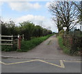
Chilton Moor Lane, Bridgwater
From the west side of Chilton Road at the northern edge of Bridgwater.
A sign on the right shows NO UNAUTHORISED VEHICLES.
Image: © Jaggery
Taken: 3 Apr 2017
0.21 miles