1
Footpath and reeds by River Parrett, Bridgwater
Image: © David Smith
Taken: 5 Aug 2020
0.05 miles
2
Change of house type, Chilton Street, Bridgwater
At a bend on the east side of the street.
Image: © Jaggery
Taken: 3 Apr 2017
0.06 miles
3
Escott Court Bridgwater
Flats set back from the west side of Chilton Street.
Image: © Jaggery
Taken: 3 Apr 2017
0.08 miles
4
Somerset Highways van in Bridgwater
Displaying the traditional red dragon emblem of Somerset, the highway
maintenance van is parked at the southern end of Chilton Street.
Image: © Jaggery
Taken: 3 Apr 2017
0.08 miles
5
Unnamed side road in the north of Bridgwater
On the northwest side of the corner of Chilton Street and Kendale Road.
Chilton Street electricity substation http://www.geograph.org.uk/photo/5339164 is in the wooden enclosure on the right.
Image: © Jaggery
Taken: 3 Apr 2017
0.08 miles
6
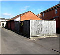
Chilton Street electricity substation, Bridgwater
The Western Power Distribution electricity substation is in a wooden enclosure set back from Chilton Street near the corner of Kendale Road. Its identifier is CHILTON STREET B1024.
Image: © Jaggery
Taken: 3 Apr 2017
0.08 miles
7
Ordnance Survey Cut Mark
This OS cut mark can be found on The British Flag PH. It marks a point 7.638m above mean sea level.
Image: © Adrian Dust
Taken: 16 Jan 2023
0.08 miles
8
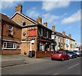
The British Flag pub in Bridgwater
Pub at 77 Chilton Street. http://www.geograph.org.uk/photo/5335207 to the name sign.
Image: © Jaggery
Taken: 3 Apr 2017
0.09 miles
9
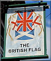
The British Flag pub name sign, Bridgwater
Hanging from a wall bracket here. http://www.geograph.org.uk/photo/5335198
Image: © Jaggery
Taken: 3 Apr 2017
0.09 miles
10
The River Parrett at Bridgwater
Flowing north out of the town towards the Bristol Channel, past flood defence walls.
Image: © Ken Grainger
Taken: 19 Nov 2007
0.10 miles


