IMAGES TAKEN NEAR TO
Shurton Lane, BRIDGWATER, TA5 1QL

Introduction

This page details the photographs taken nearby to Shurton Lane, TA5 1QL by members of the Geograph project.

The Geograph project started in 2005 with the aim of publishing, organising and preserving representative images for every square kilometre of Great Britain, Ireland and the Isle of Man.

There are currently over 7.5m images from over14,400 individuals and you can help contribute to the project by visiting https://www.geograph.org.uk

Image Map


Images are licensed for reuse under creativecommons.org/licenses/by-sa/2.0
Notes
  • Clicking on the map will re-center to the selected point.
  • The higher the marker number, the further away the image location is from the centre of the postcode.

Image Listing (7 Images Found)

Images are licensed for reuse under creativecommons.org/licenses/by-sa/2.0
Image
Details
Distance
1
Stile, Shurton Lane
A bit further north than one might expect to find the stile for the path (WL 23/28) to Little Water Farm.
Image: © Derek Harper Taken: 26 Apr 2014
0.09 miles
2
Field near Stogursey
A long, wedge-shaped triangular field narrowing to a point at the far end. It is beside the track shown in Image] - a tree appears in both images. Behind is Farringdon Hill, in Image
Image: © Derek Harper Taken: 26 Apr 2014
0.11 miles
3
Path from Shurton Lane
The line of public footpath WL 23/22 to Newnham House.
Image: © Derek Harper Taken: 26 Apr 2014
0.11 miles
4
Track to sewage works, Stogursey
Seen from Shurton Lane, and running between hedges towards the valley of the Stogursey Brook.
Image: © Derek Harper Taken: 26 Apr 2014
0.12 miles
5
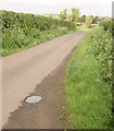
Shurton Lane
The lane from Stogursey northwards, with the hamlet of Shurton visible ahead. View from beside the field boundary shown in Image Is this supposed to be a puddle?
Image: © Derek Harper Taken: 26 Apr 2014
0.14 miles
6
Corrugated iron barn on Shurton Road, Stogursey
Image: © Roger Cornfoot Taken: 19 Sep 2012
0.17 miles
7
Lime Street, Stogursey
Image: © Roger Cornfoot Taken: 19 Sep 2012
0.25 miles