IMAGES TAKEN NEAR TO
Doniford Road, TAUNTON, TA4 4SD
Introduction
This page details the photographs taken nearby to Doniford Road, TA4 4SD by members of the Geograph project.
The Geograph project started in 2005 with the aim of publishing, organising and preserving representative images for every square kilometre of Great Britain, Ireland and the Isle of Man.

There are currently over 7.5m images from over14,400 individuals and you can help contribute to the project by visiting https://www.geograph.org.uk
Image Map
Images are licensed for reuse under creativecommons.org/licenses/by-sa/2.0
Notes
- Clicking on the map will re-center to the selected point.
- The higher the marker number, the further away the image location is from the centre of the postcode.
Image Listing (46 Images Found)
Images are licensed for reuse under creativecommons.org/licenses/by-sa/2.0
Image
Details
Distance
4
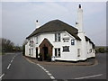
Channel to Channel (520)
The B3191 bears left at the "Masons Arms". See also http://www.geograph.org.uk/photo/2882745.
Image: © Shazz
Taken: 2 May 2015
0.08 miles
5

The Mason's Arms, Williton
Thatched pub offering bed and breakfast.
Image: © Stephen McKay
Taken: 1 Apr 2012
0.08 miles
6
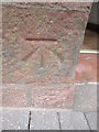
Ordnance Survey Cut Mark
This OS cut mark can be found on the front of the Masons Arms. It marks a point 28.415m above mean sea level.
Image: © Adrian Dust
Taken: 18 Mar 2016
0.08 miles
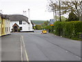
7
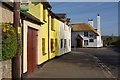
North Street, Williton
Looking towards the Mason's Arms on a sunny Sunday morning.
Image: © Stephen McKay
Taken: 1 Apr 2012
0.09 miles
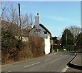
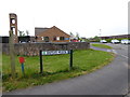
8
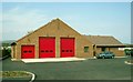
Williton Fire Station
Williton Fire Station, North Street, Williton, Somerset, replacing the old station (see Image)
Image: © Kevin Hale
Taken: 25 Apr 1993
0.09 miles
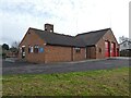
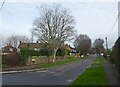
10
Channel to Channel (521)
This is the end of Shutgate Meadow and is where the footpath from Priest Street is supposed to emerge - see http://www.geograph.org.uk/photo/4470101. Now the diversion I was forced to make is complete. The fire station is on the left.
Image: © Shazz
Taken: 2 May 2015
0.10 miles