IMAGES TAKEN NEAR TO
Lower Vexford, TAUNTON, TA4 3QJ
Introduction
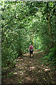
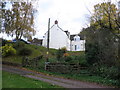
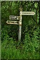
This page details the photographs taken nearby to Lower Vexford, TA4 3QJ by members of the Geograph project.
The Geograph project started in 2005 with the aim of publishing, organising and preserving representative images for every square kilometre of Great Britain, Ireland and the Isle of Man.

There are currently over 7.5m images from over14,400 individuals and you can help contribute to the project by visiting https://www.geograph.org.uk
Image Map (Loading...)


Getting Data...Please wait
Leaflet Map data © OpenStreetMap
Images are licensed for reuse under creativecommons.org/licenses/by-sa/2.0
Notes
- Clicking on the map will re-center to the selected point.
- The higher the marker number, the further away the image location is from the centre of the postcode.
Image Listing (16 Images Found)
Images are licensed for reuse under creativecommons.org/licenses/by-sa/2.0
Image
Details
Distance
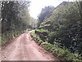
5
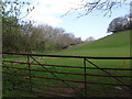
Meadow near Lower Vexford
From the lane near Yeaw Farm, with a tributary of the Doniford Stream on the far side. The meadow has been identified as part of a Catch Water Irrigation System http://webapp1.somerset.gov.uk/her/details.asp?prn=26764 .
Image: © Derek Harper
Taken: 3 Jun 2010
0.06 miles