IMAGES TAKEN NEAR TO
Wiveliscombe, TAUNTON, TA4 2UP
Introduction
This page details the photographs taken nearby to TA4 2UP by members of the Geograph project.
The Geograph project started in 2005 with the aim of publishing, organising and preserving representative images for every square kilometre of Great Britain, Ireland and the Isle of Man.

There are currently over 7.5m images from over14,400 individuals and you can help contribute to the project by visiting https://www.geograph.org.uk
Image Map
Images are licensed for reuse under creativecommons.org/licenses/by-sa/2.0
Notes
- Clicking on the map will re-center to the selected point.
- The higher the marker number, the further away the image location is from the centre of the postcode.
Image Listing (6 Images Found)
Images are licensed for reuse under creativecommons.org/licenses/by-sa/2.0
Image
Details
Distance
1
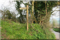
Wiveliscombe: Whitefield Rocks
Start of public footpath running north west past Cordings Farm
Image: © Martin Bodman
Taken: 22 Apr 2006
0.06 miles
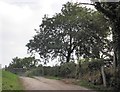
2
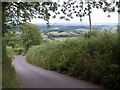
Whitefield Rocks
A steep lane from Higher Whitefield Farm to the hamlet of Whitefield.
Image: © Derek Harper
Taken: 7 Jul 2010
0.07 miles
3
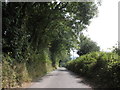
Whitefield Rocks
....seemed rather quiet when I was there....
Image: © Roger Cornfoot
Taken: 28 Aug 2013
0.12 miles
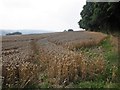
4
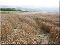
Wheat crop, ready for harvest at Higher Whitefield Farm
Image: © Roger Cornfoot
Taken: 28 Aug 2013
0.17 miles
6
Field of wheat, Higher Whitefield Farm
Image: © Roger Cornfoot
Taken: 28 Aug 2013
0.22 miles