IMAGES TAKEN NEAR TO
Ham, Creech St. Michael, TAUNTON, TA3 5NT
Introduction
This page details the photographs taken nearby to TA3 5NT by members of the Geograph project.
The Geograph project started in 2005 with the aim of publishing, organising and preserving representative images for every square kilometre of Great Britain, Ireland and the Isle of Man.

There are currently over 7.5m images from over14,400 individuals and you can help contribute to the project by visiting https://www.geograph.org.uk
Image Map
Images are licensed for reuse under creativecommons.org/licenses/by-sa/2.0
Notes
- Clicking on the map will re-center to the selected point.
- The higher the marker number, the further away the image location is from the centre of the postcode.
Image Listing (20 Images Found)
Images are licensed for reuse under creativecommons.org/licenses/by-sa/2.0
Image
Details
Distance
1
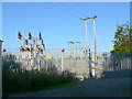
Electrical Substation
This small substation is located on the southern side of the lane leading to the local sewage works just south west of Ham and south east of Creech St Michael
Image: © Nigel Mykura
Taken: 22 Jul 2012
0.01 miles
2
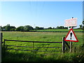
Fields at Lane End
These power lines run from a small electrical substation situated on the lane running down to a medium sized sewage works. It is uncertain what the hazard warning sign is for. One of the houses at lane End is just visible on the extreme left.
Image: © Nigel Mykura
Taken: 22 Jul 2012
0.06 miles
3
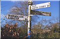
Direction Sign - Signpost at Lane End
Pyramid finial - 3 arms; Somerset SCC pyramid by the UC road, in parish of Thornfalcon (Taunton Deane District), at Lane End on the west side of the T junction of Ham Road and White Street.
surveyed
Milestone Society National ID: SO_ST2724A
Image: © Milestone Society
Taken: Unknown
0.15 miles
5
Lane past pillbox near Chard Canal
On the right is a pillbox forming part of the Taunton Stop Line.
Image: © Derek Harper
Taken: 1 Apr 2006
0.16 miles
7
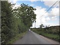
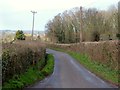
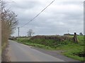
Ham Road
This road runs parallel to the River Tone, just over 100 metres to the left.
Image: © Derek Harper
Taken: 9 Oct 2009
0.20 miles
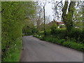
8
Bridge at Lane End, on Ham Road
A small bridge over a stream that drains into the River Tone, a few hundred metres to the left
Image: © David Smith
Taken: 26 Dec 2015
0.20 miles
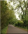
9
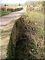
Deep ditch beside White Street, Ham
A substantial ditch to aid drainage of the low-lying land beside the River Tone
Image: © David Smith
Taken: 26 Dec 2015
0.21 miles
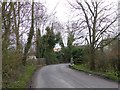
10
Canal bridge, Thornfalcon
Looking in the other direction from where Image] was taken along the eastern parapet of the bridge over the Chard Canal.
Image: © Derek Harper
Taken: 1 Apr 2006
0.22 miles