IMAGES TAKEN NEAR TO
Durston, TAUNTON, TA3 5AD
Introduction
This page details the photographs taken nearby to TA3 5AD by members of the Geograph project.
The Geograph project started in 2005 with the aim of publishing, organising and preserving representative images for every square kilometre of Great Britain, Ireland and the Isle of Man.

There are currently over 7.5m images from over14,400 individuals and you can help contribute to the project by visiting https://www.geograph.org.uk
Image Map
Images are licensed for reuse under creativecommons.org/licenses/by-sa/2.0
Notes
- Clicking on the map will re-center to the selected point.
- The higher the marker number, the further away the image location is from the centre of the postcode.
Image Listing (20 Images Found)
Images are licensed for reuse under creativecommons.org/licenses/by-sa/2.0
Image
Details
Distance
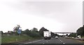
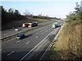
1
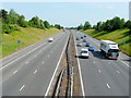
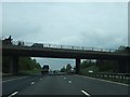
M5 northbound
Looking from the A361 bridge.
I can't quite make out the name of the Eddie Stobart lorry, it's D- M-.
Image: © Jonathan Billinger
Taken: 4 Jun 2009
0.08 miles
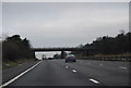
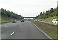
2
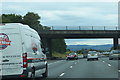
On the M5
The bridge carrying the A 361 at Higher Durston.
Image: © Robert Ashby
Taken: 16 Aug 2014
0.08 miles
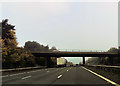
6
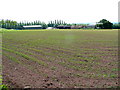
Drake's Barton
View from A361 across a recently-planted field of maize
Image: © Jonathan Billinger
Taken: 4 Jun 2009
0.11 miles