IMAGES TAKEN NEAR TO
Cheddon Fitzpaine, TAUNTON, TA2 8LD
Introduction
This page details the photographs taken nearby to TA2 8LD by members of the Geograph project.
The Geograph project started in 2005 with the aim of publishing, organising and preserving representative images for every square kilometre of Great Britain, Ireland and the Isle of Man.

There are currently over 7.5m images from over14,400 individuals and you can help contribute to the project by visiting https://www.geograph.org.uk
Image Map
Images are licensed for reuse under creativecommons.org/licenses/by-sa/2.0
Notes
- Clicking on the map will re-center to the selected point.
- The higher the marker number, the further away the image location is from the centre of the postcode.
Image Listing (13 Images Found)
Images are licensed for reuse under creativecommons.org/licenses/by-sa/2.0
Image
Details
Distance
1
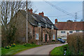
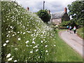
Upper Cheddon : Country Lane
Looking along a country lane and towards Barton House.
Image: © Lewis Clarke
Taken: 9 Mar 2019
0.05 miles
2
Taunton Deane : Grass Field
A field near Manor Farm.
Image: © Lewis Clarke
Taken: 9 Mar 2019
0.10 miles
3
Taunton Deane : Muddy Field
A muddy field in the countryside.
Image: © Lewis Clarke
Taken: 9 Mar 2019
0.11 miles
4
Taunton Deane : Muddy Field
A muddy field in the countryside.
Image: © Lewis Clarke
Taken: 9 Mar 2019
0.11 miles
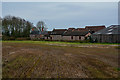
6
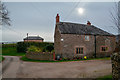
Upper Cheddon : Manor Farm
Manor Farm in Upper Cheddon.
Image: © Lewis Clarke
Taken: 9 Mar 2019
0.16 miles
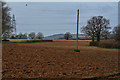
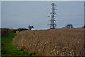
7
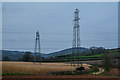
Taunton Deane : Countryside Scenery
Looking towards a field and pylons.
Image: © Lewis Clarke
Taken: 9 Mar 2019
0.16 miles
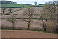
9
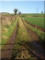
Track across field, Upper Cheddon
From the lane between Upper Cheddon and Kingston St Mary, looking alongside a field boundary, as the ground rises steadily towards the Quantocks.
Image: © Derek Harper
Taken: 17 Jan 2009
0.17 miles
10
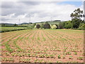
Taunton Deane : Crop Field
A field of crops with a grassy path alongside it.
Image: © Lewis Clarke
Taken: 9 Mar 2019
0.20 miles