IMAGES TAKEN NEAR TO
Park Lane, MINEHEAD, TA24 6LY
Introduction
This page details the photographs taken nearby to Park Lane, TA24 6LY by members of the Geograph project.
The Geograph project started in 2005 with the aim of publishing, organising and preserving representative images for every square kilometre of Great Britain, Ireland and the Isle of Man.

There are currently over 7.5m images from over14,400 individuals and you can help contribute to the project by visiting https://www.geograph.org.uk
Image Map (Loading...)


Getting Data...Please wait
Leaflet Map data © OpenStreetMap
Images are licensed for reuse under creativecommons.org/licenses/by-sa/2.0
Notes
- Clicking on the map will re-center to the selected point.
- The higher the marker number, the further away the image location is from the centre of the postcode.
Image Listing (103 Images Found)
Images are licensed for reuse under creativecommons.org/licenses/by-sa/2.0
Image
Details
Distance
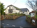
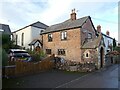
3
Junction with High Street, Carhampton
Image: © Roger Cornfoot
Taken: 26 Dec 2021
0.03 miles
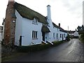
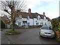
7

Carhampton : High Street
Looking up the High Street from Station Road.
Image: © Lewis Clarke
Taken: 9 Apr 2016
0.06 miles
8
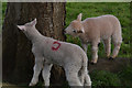
Carhampton : Lambs Grazing
Lambs enjoy the bark from the tree.
Image: © Lewis Clarke
Taken: 9 Apr 2016
0.07 miles
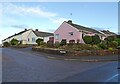
9

Carhampton : Lambs Grazing
Lambs in a grassy field in the centre of Carhampton.
Image: © Lewis Clarke
Taken: 9 Apr 2016
0.07 miles
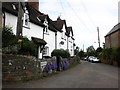
10
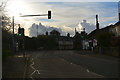
Carhampton : Station Road A39
Looking along Station Road as it heads through Carhampton.
Image: © Lewis Clarke
Taken: 9 Apr 2016
0.07 miles