IMAGES TAKEN NEAR TO
Newbarn Park Road, TAUNTON, TA1 4NF
Introduction
This page details the photographs taken nearby to Newbarn Park Road, TA1 4NF by members of the Geograph project.
The Geograph project started in 2005 with the aim of publishing, organising and preserving representative images for every square kilometre of Great Britain, Ireland and the Isle of Man.

There are currently over 7.5m images from over14,400 individuals and you can help contribute to the project by visiting https://www.geograph.org.uk
Image Map
Images are licensed for reuse under creativecommons.org/licenses/by-sa/2.0
Notes
- Clicking on the map will re-center to the selected point.
- The higher the marker number, the further away the image location is from the centre of the postcode.
Image Listing (14 Images Found)
Images are licensed for reuse under creativecommons.org/licenses/by-sa/2.0
Image
Details
Distance
1
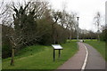
South Taunton Southern Streams Nature Reserve
Image: © Nick Chipchase
Taken: 30 Mar 2009
0.10 miles
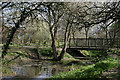
2
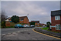
Horts Cottages, Comeytrowe
Horts Cottages centre right. Queens College on the skyline.
Image: © Nick Chipchase
Taken: 30 Mar 2009
0.13 miles
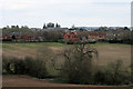
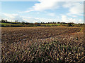
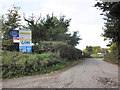
4
Farmland at Comeytrowe
With outline planning for 2000 houses.
Image: © Nick Chipchase
Taken: 29 Jan 2016
0.16 miles
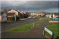
5
Comeytrowe : Queensway
Looking along Queensway from Comeytrowe Lane.
Image: © Lewis Clarke
Taken: 31 Dec 2019
0.17 miles
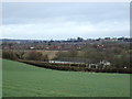
6
Fields at Comeytrowe
These could all be built on according to plans in hand.
Image: © Nick Chipchase
Taken: 11 Jan 2016
0.18 miles
8
Comeytrowe : Queensway
Looking along Queensway from Comeytrowe Road.
Image: © Lewis Clarke
Taken: 31 Dec 2019
0.19 miles
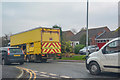
9
Entrance to Comeytrowe Industrial Estate
Image: © Roger Cornfoot
Taken: 22 Sep 2011
0.20 miles
10
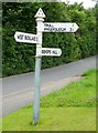
Old Direction Sign - Signpost by Coneytrowe Lane, Taunton parish
Pyramid finial - 3 arms; Somerset SCC pyramid (Sheldon) by the UC road, in parish of Taunton (Taunton Deane District), Coneytrowe Lane, junction with Queensway, Gamlington.
Surveyed
Milestone Society National ID: SO_ST2023
Image: © Alan Rosevear
Taken: 4 Jul 2012
0.21 miles