IMAGES TAKEN NEAR TO
Vivary Road, TAUNTON, TA1 3JW

Introduction

This page details the photographs taken nearby to Vivary Road, TA1 3JW by members of the Geograph project.

The Geograph project started in 2005 with the aim of publishing, organising and preserving representative images for every square kilometre of Great Britain, Ireland and the Isle of Man.

There are currently over 7.5m images from over14,400 individuals and you can help contribute to the project by visiting https://www.geograph.org.uk

Image Map


Images are licensed for reuse under creativecommons.org/licenses/by-sa/2.0
Notes
  • Clicking on the map will re-center to the selected point.
  • The higher the marker number, the further away the image location is from the centre of the postcode.

Image Listing (269 Images Found)

Images are licensed for reuse under creativecommons.org/licenses/by-sa/2.0
  • ...
Image
Details
Distance
1
Remaining part of Wilton Prison
The prison yard was where the cars are now parked.
Image: © Nick Chipchase Taken: 23 Mar 2009
0.04 miles
2
Wilton Parish Hall
Viewed from churchyard.
Image: © Nick Chipchase Taken: 16 May 2012
0.05 miles
3
Taunton: former County Gaol
The prison buildings are behind the police station. According to the Somerset Historic Environment Record the area was shown as "HM Military Prison" on the 1899 Ordnance Survey map and as a drill hall in 1903.
Image: © John Sutton Taken: 14 Jun 2015
0.07 miles
4
Old school style
This community hall attached to St George's church used to be a school.
Image: © Neil Owen Taken: 8 Oct 2014
0.07 miles
5
Taunton Police Station
This is the back entrance of the police station in Burton Place showing the main tower.
Image: © Adrian Boliston Taken: 28 May 2007
0.07 miles
6
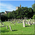
Wilton churchyard
Gravestones and yews on a bright July morning.
Image: © John Sutton Taken: 9 Jul 2019
0.07 miles
7
Playground at Wilton
Image: © Nick Chipchase Taken: 13 Apr 2009
0.07 miles
8
Homely station
This unassuming semi-detached was a police station in its past. See Image] for the stone.
Image: © Neil Owen Taken: 8 Oct 2014
0.08 miles
9
Police house
An inscribed stone tablet is all that marks an ordinary semi-detached as a former cop shop. See Image] for a look.
Image: © Neil Owen Taken: 8 Oct 2014
0.08 miles
10
Taunton: behind Wilton House
A narrow alley leading from Upper High Street to the weir and the park.
Image: © John Sutton Taken: 14 Jun 2015
0.08 miles
  • ...