IMAGES TAKEN NEAR TO
Ryburn Close, TAUNTON, TA1 2RH
Introduction
This page details the photographs taken nearby to Ryburn Close, TA1 2RH by members of the Geograph project.
The Geograph project started in 2005 with the aim of publishing, organising and preserving representative images for every square kilometre of Great Britain, Ireland and the Isle of Man.

There are currently over 7.5m images from over14,400 individuals and you can help contribute to the project by visiting https://www.geograph.org.uk
Image Map (Loading...)


Getting Data...Please wait
Leaflet Map data © OpenStreetMap
Images are licensed for reuse under creativecommons.org/licenses/by-sa/2.0
Notes
- Clicking on the map will re-center to the selected point.
- The higher the marker number, the further away the image location is from the centre of the postcode.
Image Listing (12 Images Found)
Images are licensed for reuse under creativecommons.org/licenses/by-sa/2.0
Image
Details
Distance
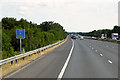
4
Location sign on M5 southbound near Taunton
Part of the short section of the M5 in this gridsquare
Image: © David Smith
Taken: 11 May 2018
0.21 miles
5
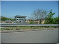
Taunton Deane : Ashfords Solicitors
A building for Ashford's Solicitors taken from the M5 Motorway.
Image: © Lewis Clarke
Taken: 19 Apr 2009
0.22 miles
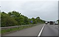
7

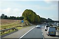
Taunton : M5 Motorway
The M5 Motorway between Junction 26 (Chelston) and Junction 25 (Blackbrook Interchange).
Image: © Lewis Clarke
Taken: 22 Sep 2019
0.23 miles
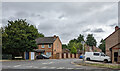
8
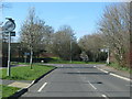
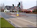
T-junction on the outskirts of Taunton
Image: © Sarah Charlesworth
Taken: 20 Mar 2011
0.24 miles
9
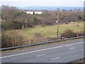
Higher Holway, Taunton
A couple take their dog for a walk in this little area of green space between the residential suburb of Holway and the M5, foreground. View looking NNW from the Haydon Road bridge over the motorway. 2:36 pm.
Image: © Derek Harper
Taken: 11 Mar 2006
0.24 miles
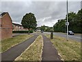
10
Pedestrian crossing on Lisieux Way
In the background is the Master Thatcher pub - see also Image On the right is part of a Tesco supermarket.
Image: © Derek Harper
Taken: 11 Mar 2006
0.24 miles