IMAGES TAKEN NEAR TO
Snedden Grove, TAUNTON, TA1 2AP
Introduction
This page details the photographs taken nearby to Snedden Grove, TA1 2AP by members of the Geograph project.
The Geograph project started in 2005 with the aim of publishing, organising and preserving representative images for every square kilometre of Great Britain, Ireland and the Isle of Man.

There are currently over 7.5m images from over14,400 individuals and you can help contribute to the project by visiting https://www.geograph.org.uk
Image Map
Images are licensed for reuse under creativecommons.org/licenses/by-sa/2.0
Notes
- Clicking on the map will re-center to the selected point.
- The higher the marker number, the further away the image location is from the centre of the postcode.
Image Listing (28 Images Found)
Images are licensed for reuse under creativecommons.org/licenses/by-sa/2.0
Image
Details
Distance
2

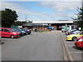
Taunton : ASDA
Looking along the aisles of ASDA.
Image: © Lewis Clarke
Taken: 5 Apr 2021
0.13 miles
3

Graffiti, Taunton
This example is in a subway beneath the A38 (the Toneway).
Image: © Derek Harper
Taken: 23 Oct 2008
0.14 miles
5
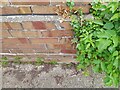
Ordnance Survey Cut Mark
This OS cut mark can be found on No58 Leycroft Road. It marks a point 15.670m above mean sea level.
Image: © Adrian Dust
Taken: 12 Jul 2023
0.18 miles
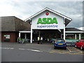
6

Taunton : ASDA Supercentre
ASDA supercentre is open 24 hours according to the little red sign.
Image: © Lewis Clarke
Taken: 17 Jun 2008
0.18 miles

10

Graffiti, Taunton
In a subway beneath the A358.
Image: © Derek Harper
Taken: 23 Oct 2008
0.19 miles