IMAGES TAKEN NEAR TO
Chestnut Road, MARTOCK, TA12 6DP

Introduction

This page details the photographs taken nearby to Chestnut Road, TA12 6DP by members of the Geograph project.

The Geograph project started in 2005 with the aim of publishing, organising and preserving representative images for every square kilometre of Great Britain, Ireland and the Isle of Man.

There are currently over 7.5m images from over14,400 individuals and you can help contribute to the project by visiting https://www.geograph.org.uk

Image Map


Images are licensed for reuse under creativecommons.org/licenses/by-sa/2.0
Notes
  • Clicking on the map will re-center to the selected point.
  • The higher the marker number, the further away the image location is from the centre of the postcode.

Image Listing (110 Images Found)

Images are licensed for reuse under creativecommons.org/licenses/by-sa/2.0
  • ...
Image
Details
Distance
1
Beech Road, Martock
Image: © Roger Cornfoot Taken: 14 Sep 2016
0.08 miles
2
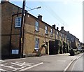
Terraced houses on North Street
Image: © Roger Cornfoot Taken: 14 Sep 2016
0.11 miles
3
Temporary traffic Lights
These temporary traffic lights which are there for road works are on North Street, the B3165, the main road through the village close to its junction with Beech Road.
Image: © Nigel Mykura Taken: 2 May 2013
0.11 miles
4
A distant view of Martock from Ham Hill
Image: © Nick Chipchase Taken: 5 Jun 2015
0.11 miles
5
Takeaways on North Street
Image: © Roger Cornfoot Taken: 14 Sep 2016
0.12 miles
6
Methodist Church, Martock
Image: © Roger Cornfoot Taken: 14 Sep 2016
0.13 miles
7
Houses in North Street, Martock
Image: © David Gearing Taken: 11 Jul 2012
0.13 miles
8
Building outside Moorlands Shopping Centre
Image: © Roger Cornfoot Taken: 14 Sep 2016
0.15 miles
9
Businesses in Martock
Is this a former mill of some kind?
Image: © Jonathan Thacker Taken: 18 Sep 2018
0.16 miles
10
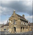
The Market House Martock
Image: © Pam Goodey Taken: 5 Apr 2009
0.17 miles
  • ...